File:Visayas_Red.png · Wikimedia Commons · See Wikimedia Commons
Visayas
Sign in to saveAlso known as Visayan Islands, Visayas island group
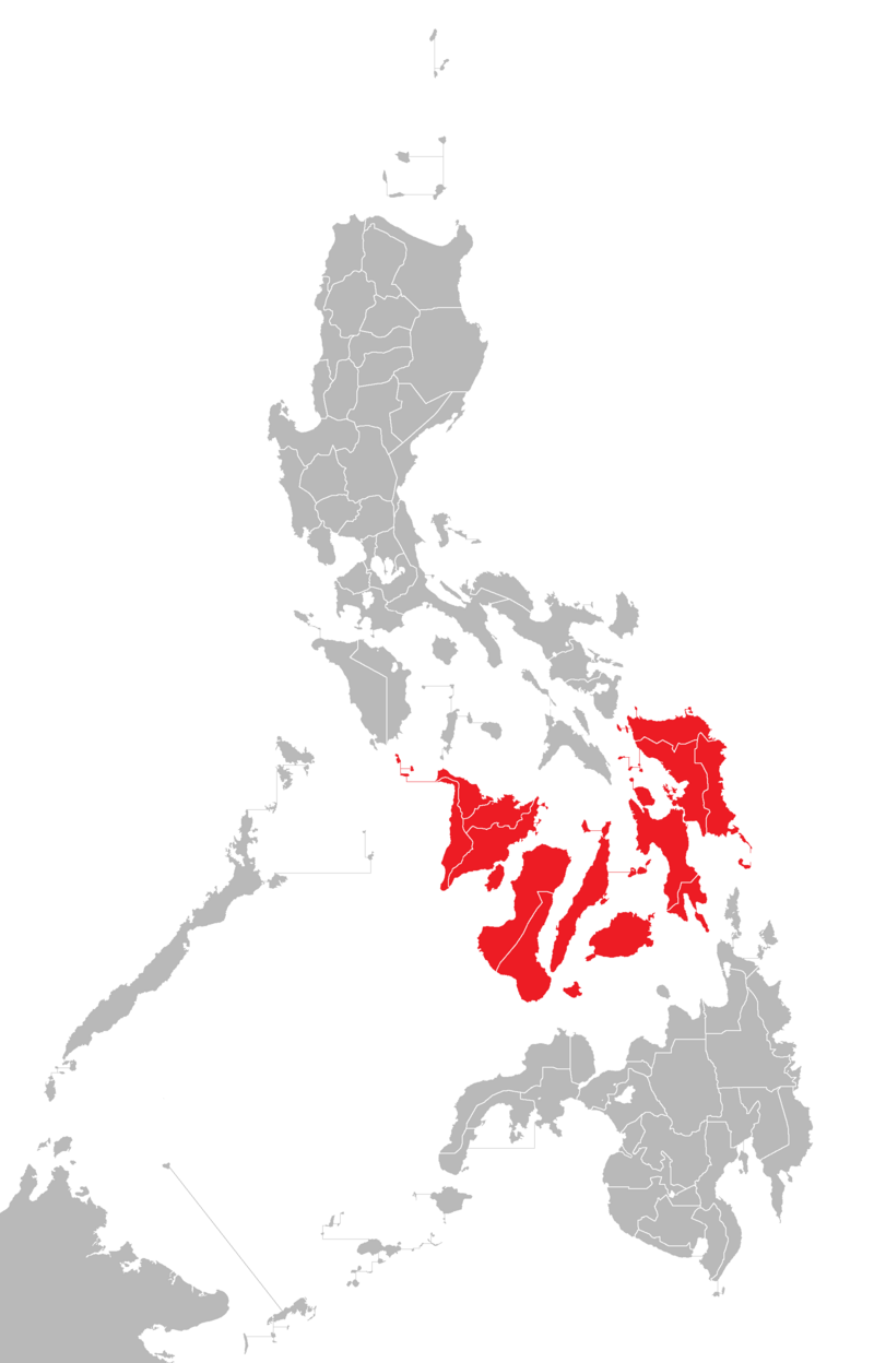
The Visayas ( ), or the Visayan Islands (Visayan: Kabisay-an, ; Filipino: Kabisayaan ), are one of the three principal geographical divisions of the Philippines, along with Luzon and Mindanao. Located in the central part of the archipelago, it consists of several islands, primarily surrounding the Visayan Sea, although the Visayas are also considered the northeast extremity of the entire Sulu Sea. Its inhabitants are predominantly the Visayan peoples.
The Visayas is one of three main geographical regions of the Philippines, located in the central part of the country and made up of several islands that surround the Visayan Sea. The region is home to the Visayan peoples and represents an important cultural and geographical division of the Philippine archipelago.
AI-generated from the Wikipedia summary — may contain errors.
Key facts
- Islands.highest_mount
- Mount Kanlaon
- Islands.elevation_m
- 2465
- Islands.country_admin_divisions_title
- Regions
- Islands.population
- 21,155,014
- Islands.population_as_of
- 2021
- Islands.density_km2
- 292
- Islands.name
- Visayas
- Islands.image_name
- Visayas Red.png
- Islands.image_caption
- Location of the Visayas within the Philippines
- Islands.native_name_link
- Visayan languages
- Islands.location
- Southeast Asia
- Islands.archipelago
- Philippines
- Islands.area_km2
- 71,503
- Islands.country_largest_city
- Cebu City
- Islands.country_largest_city_population
- 964,169
via Wikipedia infobox
Wikidata facts
- Has part
- Siquijor
- Country
- Philippines
- Located in
- Philippines
- Contains
- Negros Island Region
- Population
- 21033659
- Area
- 71503
- Highest point
- Kanlaon Volcano
- Image
- Visayas Red.png
- Households
- 4988683
Show 4 more facts
- Commons category
- Visayas
- topic's main category
- Category:Visayas
- electorate
- 13836781
- poverty incidence
- 34.50
Sources (8)
via Wikidata · CC0
~19 min read
Encyclopedic overview
20 sectionsContents
- Etymology
- Pre-colonial etymology
- Colonial etymology
- History
- Mythical allusions and hypotheses
- Geography
- List of islands by population
- Culture and festivals
- Administrative divisions
- Western Visayas (Region VI)
- Negros Island Region (NIR)
- Central Visayas (Region VII)
- Eastern Visayas (Region VIII)
- Demographics
- Languages
- ''Cebuano'' versus ''Bisaya''
- See also
- Notes
- References
- External links
The Visayas ( ), or the Visayan Islands (Visayan: Kabisay-an, ; Filipino: Kabisayaan ), are one of the three principal geographical divisions of the Philippines, along with Luzon and Mindanao. Located in the central part of the archipelago, it consists of several islands, primarily surrounding the Visayan Sea, although the Visayas are also considered the northeast extremity of the entire Sulu Sea. Its inhabitants are predominantly the Visayan peoples.
The major islands of the Visayas are Panay, Negros, Cebu, Bohol, Leyte and Samar. The region may also include the provinces of Palawan, Romblon, and Masbate, whose populations identify as Visayan and whose languages are more closely related to other Visayan languages than to the major languages of Luzon.
Excerpted from Wikipedia’s “Visayas” article, available under the CC BY-SA 4.0 licence.
Gallery (38)
On the map
3 mapped locations
Available in 65 languages
- Español
- Français
- Deutsch
- 中文
- 日本語
- Русский
- Português
- Italiano
- العربية
- हिन्दी
- Afrikaans
- Armenian
- Asturian
- Azerbaijani
- Bahasa Indonesia
- Basque
- Bikol
- Breton
Show 46 more
- Catalan
- cbk_zam
- Cebuano
- Croatian
- Czech
- Danish
- Esperanto
- Estonian
- Filipino
- Finnish
- Galician
- Georgian
- Greek
- Hakka Chinese
- Hebrew
- Hungarian
- Iloko
- Interlingua
- Latvian
- Lithuanian
- Macedonian
- Malagasy
- Malay
- Marathi
- Nederlands
- Northern Frisian
- Norwegian
- Norwegian Nynorsk
- Pampanga
- Polski
- Romanian
- Serbian
- simple
- Svenska
- Tamil
- Tiếng Việt
- Toki Pona
- Türkçe
- Ukrainian
- Urdu
- Waray
- Wu Chinese
- zh_yue
- فارسی
- ไทย
- 한국어
via Wikidata sitelinks · CC0