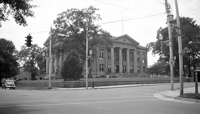
File:Wayne_County_Courthouse_1948.jpg · Wikimedia Commons · See Wikimedia Commons
Wayne County
Sign in to saveAlso known as Wayne County, North Carolina, Wayne County, NC
county in North Carolina, United States
Key facts
- Country
- United States
- State
- North Carolina
- Named after
- Anthony Wayne
- Seat
- Goldsboro
- Largest community
- Goldsboro
- Total
- 557.72 sq mi (1,444.5 km )
- Land
- 553.92 sq mi (1,434.6 km )
- Water
- 3.80 sq mi (9.8 km ) 0.68%
- Estimate 2025
- 122,278
- Density
- 211.74/sq mi (81.75/km )
- Time zone
- UTC−5 ( Eastern )
- Summer dst
- UTC−4 ( EDT )
- Congressional district
- 1st
- Website
- www .waynegov .com
via Wikipedia infobox
Wikidata facts
- Population
- 117333
- Area
- 557
- Official website
- www.waynegov.com
- Image
- Wayne County Courthouse 1948.jpg
- Households
- 48198
Show 7 more facts
- Commons category
- Wayne County, North Carolina
- inception
- 1779-01-01
- water as percent of area
- 0.7
- native label
- Wayne County
- social media followers
- 1361
- per capita income
- 26362
- number of viewers/listeners
- 276206
Sources (12)
via Wikidata · CC0
~12 min read
Article
Wayne County is a county located in the U.S. state of North Carolina. As of the 2020 census, the population was 117,333. Its county seat is Goldsboro, and it is home to Seymour Johnson Air Force Base.
Wayne County comprises the Goldsboro, North Carolina Metropolitan Statistical Area.
Gallery (5)
On the map
Connections
African Americans
Entity
United States Census Bureau
Entity
Native Hawaiians
Entity
list of counties in North Carolina
Entity
Mount Olive
Entity
list of municipalities in North Carolina
Entity
race and ethnicity in the United States Census
Entity
maize
Entity
marriage
Entity
pig
Entity
North Carolina
Entity
time zone
Entity
climate
Entity
wheat
Entity
geographic coordinate system
Entity
cotton
Entity
tobacco
Entity
soybean
Entity
Republican Party (United States)
Concept
population density
Entity