Category
page 1Regions of Africa

North Africa
northernmost region of the African continent

West Africa
westernmost region of the African continent

East Africa
easterly region of the African continent
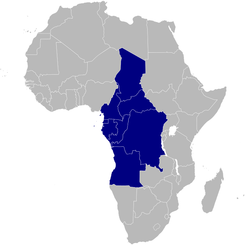
Central Africa
core region of the African continent

Southern Africa
southernmost region of Africa

Sahel
The Sahel region (; ), or Sahelian acacia savanna, is a biogeographical region in Africa. It is the transition zone between the more humid Sudanian savannas to its south and the drier Sahara to the north. The Sahel has a hot semi-arid climate and stretches across the southernmost latitudes of North Africa between the Atlantic Ocean and the Red Sea. Although geographically located in the tropics, the Sahel does not have a tropical climate.
.svg)
Maghreb
The Maghreb (; ), also known as the Arab Maghreb (), the Greater Maghreb ( al-Maghrib al-Kabīr), and Northwest Africa, is the western part of the Arab world. The region comprises western and central North Africa, including Algeria, Libya, Mauritania, Morocco, and Tunisia. The Maghreb also includes the disputed territory of Western Sahara. As of 2018, the region had a population of over 100 million people.

sub-Saharan Africa
area of the continent of Africa that lies south of the Sahara Desert

African Great Lakes
series of lakes in the Rift Valley

Nubia
Nubia ( ; Nobiin: Nⲟ̅ⲩ̅ⲃⲁ; ) is a region along the Nile river encompassing the area between the confluence of the Blue and White Niles (near Khartoum in central Sudan) and the First Cataract (south of Aswan in southern Egypt). It was the seat of one of the earliest civilizations of ancient Africa, the Kerma culture, which lasted from around 2500 BC until its conquest by the New Kingdom of Egypt under Pharaoh Thutmose I around 1500 BC. Egyptian heirs subsequently ruled much of Nubia for the next four centuries.

Mediterranean Basin
loosely defined region of lands around the Mediterranean Sea
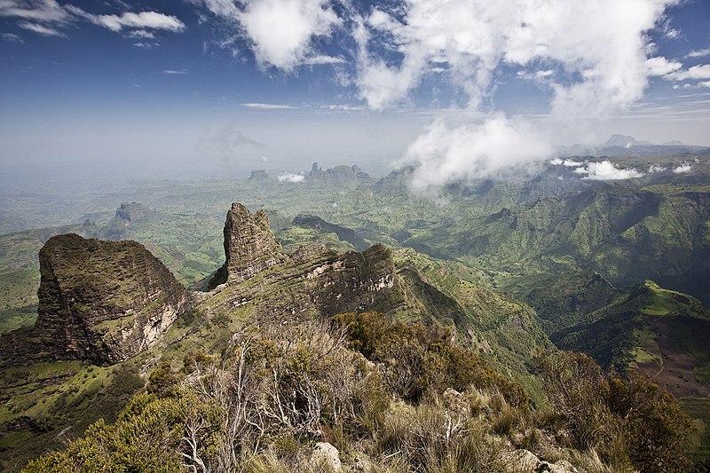
Ethiopian Highlands
mountain range in East Africa

Muslim world
Muslim-majority countries, states, districts, or towns
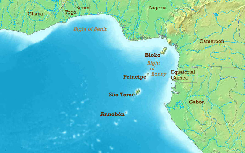
Bight of Biafra
bay off the coast of Africa
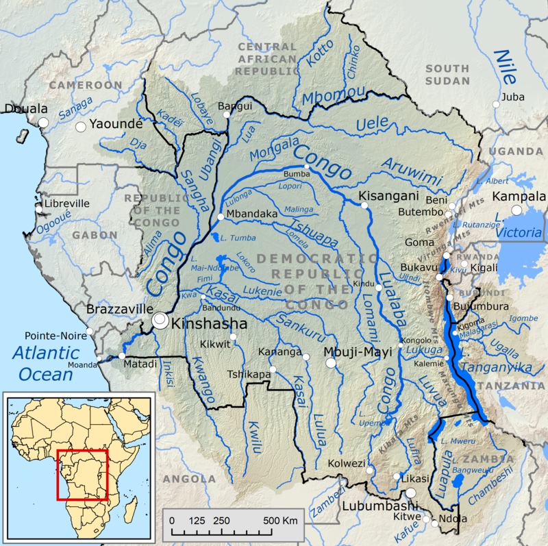
Congo Basin
basin of the Congo River in West Equatorial Africa

Afrotropical realm
one of Earth's eight biogeographic realms

Middle East and North Africa
Middle East and North Africa region
Europe, the Middle East and Africa
collective term referring to Europe, the Middle East and Africa
Swahili coast
coast of Kenya, Tanzania, and northern Mozambique, located in southeastern Africa

Matabeleland
Matabeleland is a region located in southwestern Zimbabwe that is divided into three provinces: Matabeleland North, Bulawayo, and Matabeleland South. These provinces are in the west and south-west of Zimbabwe, between the Limpopo and Zambezi rivers and are further separated from Midlands by the Shangani River in central Zimbabwe. The region is named after its inhabitants, the Ndebele people who were called "Amatabele" (people with long shields – Mzilikazi 's group of people who were escaping the Mfecani wars). Other ethnic groups who inhabit parts of Matabeleland include the Tonga, Bakalanga,

Mashonaland
thumb|Map of Zimbabwe showing Mashonaland
Highveld
The Highveld (Afrikaans: Hoëveld, , ) is the portion of the South African inland plateau which has an altitude above roughly , but below , thus excluding the Lesotho mountain regions to the south-east of the Highveld. It is home to some of the country's most important commercial farming areas, as well as its largest concentration of metropolitan centres, especially the Gauteng conurbation, which accommodates one-third of South Africa's population.
Wituland
Wituland (also Witu, Vitu, Witu Protectorate or Swahililand) was a territory of approximately in East Africa centered on the town of Witu, just inland from the Indian Ocean port of Lamu, north of the mouth of the Tana River in what is now Kenya.
Kionga Triangle
German colony in modern Mozambique

Wassoulou
thumb|right|200px|The Wassoulou region of West Africa

Borgu
Borgu is a region and former country split between north-west Nigeria and the northern Republic of Benin. It was partitioned between Great Britain and France by the Anglo-French Convention of 1898. People of Borgu are known as Bariba or Borgawa.
Fizi Territory
territory of the Democratic Republic of the Congo
Northeast Africa
or Northeastern Africa or Northern East Africa as it was known in the past

Itbay
thumb|Red Sea Hills in Egypt
thumb|Closer view of the arid, rocky Red Sea Hills
Itbāy (; ʿAtbāy / Atbai ) is a region of southeastern Egypt and northeastern Sudan. It is characterized by a chain of mountains, the Red Sea Hills, running north–south and parallel with the Red Sea. The hills separate the narrow coastal plain from the Eastern Desert.
Sudanian savanna
broad belt of tropical savanna

Azawagh
thumb|upright=1.25|The Azawagh Basin and surrounding geographical features, as seen from space. The yellow lines indicate international borders
thumb|upright=1.25|The Azawagh forms the northeastern sections of the Niger River|Niger River Basin, although today the Azawagh River is long dry, and the area is fed by seasonal underground rivers at best
Kasai region
region of the Democratic Republic of Congo
Maputaland
Maputaland is a natural region of Southern Africa. It is located in the northern part of the province of KwaZulu-Natal, South Africa between Eswatini and the coast. In a wider sense it may also include the southernmost region of Mozambique. The bird routes and coral reefs off the coast are major tourist attractions.
Liptako
Liptako is an historic region of West Africa. It today falls in eastern Burkina Faso, southwestern Niger and a small portion of southeast central Mali. A hilly region beginning on the right back of the Niger river, Liptako is usually associated with the Liptako Emirate, an early 19th-century Fulani Islamic state, founded by Brahima Saidu. A modern remnant of the emirate continues to exist as a non-sovereign monarchy. The current emir, Ousmane Amirou Dicko, lives in Dori.

Zululand
[[File:Map of definitions of Zululand-KwaZulu.svg|thumb|Map of various possible definitions of Zululand or KwaZulu:
Pondoland
Pondoland or Mpondoland (Mpondo: EmaMpondweni), is a natural region on the South African shores of the Indian Ocean. It is located in the coastal belt of the Eastern Cape province. Its territory is the former Mpondo Kingdom of the Mpondo people.
Lower Guinea
Regions of the African Union
5 geographic regions of the AU
list of regions of Africa
Wikimedia list article
Mwenga Territory
territory in South Kivu, DR Congo
Southeast Africa
southeasterly region of the African continent
Mayombe
thumb|Fetish with mirror from Mayombe
Mayombe (or Mayumbe) is a geographic area on the western coast of Africa occupied by low mountains extending from the mouth of the Congo River in the south to the Kouilou-Niari River to the north. The area includes parts of the Democratic Republic of the Congo, Angola (Cabinda Province), the Republic of the Congo and Gabon.
In the Democratic Republic of the Congo, Mayombe is part of the north-western province of Kongo Central on the right bank of the River Congo, and contains the cities and towns of Lukula, Seke Banza, Kangu and Tshela.
Beni Snassen
thumb|Iznassen
The Beni Iznassen region (in Arabic: بني سناسن,) is a low-lying mountainous region in northeastern Morocco, bordering the province of Berkan (except Saidia), the northern part of the province of Oujda, the northern part of the province of Taourirt, northwest of the closed border between Morocco and Algeria, 400 km east of Rabat, the country's capital.
Chemama
Chemama is the name of the region along the Northern bank of the Senegal River, in Mauritania: a fertile band of land extending sixteen to thirty-two kilometers north of the river and containing alluvial soil. It is the only agricultural region in the country.
Regions of Algeria
Wikimedia list article
Thembuland
Thembuland, , is a natural region in the Eastern Cape province of South Africa. Its territory is the traditional region of the abaThembu.
Mthwakazi
Mthwakazi is the traditional name of the Northern Ndebele people and their kingdom in what is now Matebeleland, Zimbabwe. The kingdom was located between the Sanyati and Limpopo rivers. Additionally, Mthwakazi is widely used to refer to inhabitants of Matebeleland Province in Zimbabwe.
Biledulgerid
__NOTOC__
thumb|Barbariae et Biledulgerid, Nova Descriptio, 1570s map by Abraham Ortelius; Biledulgerid marked in red
thumb|Generall Mapp of the Coast of Barbarie, 1667 map by Richard Blome; Biledulgerid marked in yellow and subdivided into regions
Arewa
thumb | right|Location of Arewa in Nigeria
Arewa or Arewaland is a Hausa word which means "The North". The term is used to refer to Northern Nigeria general. The terms '''' (literally "north") and Arewacin Nijeriya (literally "Northern Nigeria") are used in Hausa to refer to the historic region geopolitically located north of the River Niger.