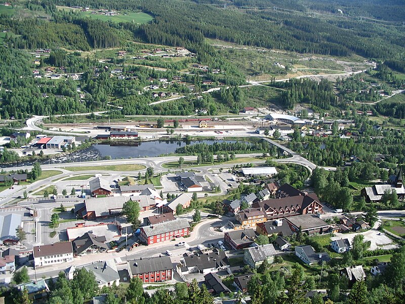
File:Ål_Village.jpg · Wikimedia Commons · See Wikimedia Commons
thumb|250px|Village of Ål in winter Ål is a municipality in Buskerud county, Norway. It is part of the traditional region of Hallingdal. The administrative centre of the municipality is the village of Ål. The parish of Aal was established as a municipality on 1 January 1838 (see formannskapsdistrikt). The area of Hol was separated from the municipality of Aal in 1877 to become a separate municipality.
Key facts
- Kommune.name
- Ål
- Kommune.idnumber
- 3328
- Kommune.image_skyline
- File:Ål Village.jpg
- Kommune.county
- Buskerud
- Kommune.district
- Hallingdal
- Kommune.capital
- Ål
- Kommune.language
- Nynorsk
- Kommune.coatofarms
- Ål komm.svg
- Kommune.flag
- Flag of Ål.gif
- Kommune.demonym
- Åling
- Kommune.munwebpage
- www.aal.kommune.no
- Kommune.mayor
- Jørund Li
- Kommune.mayor_party
- Conservative Party
- Kommune.mayor_as_of
- 2025
- Kommune.area_rank
- 85
- Kommune.area_total_km2
- 1171
- Kommune.area_land_km2
- 1081
- Kommune.area_water_percent
- 0.36
via Wikipedia infobox
Official website
Ål kommune - Ål kommune
aal.kommune.no →Link to the official site · 4,126 chars · not written by Vinony
Wikidata facts
- Demonym
- åling
- Population
- 5106
- Area
- 93.49
- Official website
- www.aal.kommune.no
- Image
- Ål.JPG
- Households
- 87
Show 3 more facts
- Commons category
- Ål
- native label
- Ål
- Commons gallery
- Ål
Sources (10)
via Wikidata · CC0
~5 min read
Article
11 sectionsContents
- Geography
- Mountains
- General information
- Name
- Coat-of-arms
- Attractions
- Notable people from Ål
- Sister cities
- See also
- References
- External links
thumb|250px|Village of Ål in winter Ål is a municipality in Buskerud county, Norway. It is part of the traditional region of Hallingdal. The administrative centre of the municipality is the village of Ål. The parish of Aal was established as a municipality on 1 January 1838 (see formannskapsdistrikt). The area of Hol was separated from the municipality of Aal in 1877 to become a separate municipality.
== Geography == 80% of Ål municipality is at least above sea level. The highest point is Raudbergnuten at . Reineskarvet, the significant mountain of Ål has a summit of . In the winter, Ål has over of maintained cross country ski trails.
Gallery (11)
On the map
3 mapped locations