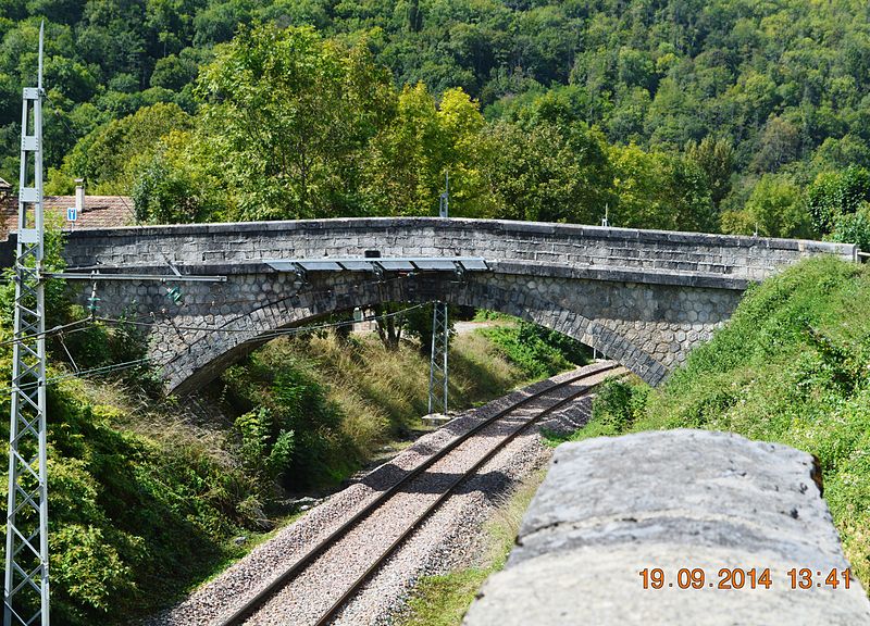
File:Albies_Railway_bridge.JPG · Wikimedia Commons · See Wikimedia Commons
Albiès
Sign in to saveAlbiès (; ) is a commune in the Ariège department in the Occitanie region of southwestern France.
OverviewAI-generated
Albiès is a commune in the Ariège department of France, situated within the Occitanie region. It lies in the arrondissement of Foix and the canton of Cabannes, while its associated electoral district is the canton of Haute-Ariège. The municipality borders the communes of Aston, Les Cabannes, Lassur, and Pech.
The area of Albiès is 7.69 square kilometers. Population figures vary slightly between sources, with one listing 163 residents and another citing 165. The demographic breakdown includes 68 males and 55 females. The postal code for the commune is 09310.
Synthesized by Vinony from 39 facts across 7 sources: Wikidata, Open Meteo, Openweathermap, OpenStreetMap, GeoNames, Vinony graph, Geo. Generated from structured data (not the Wikipedia text) and checked against those facts — may still contain errors.
In the Vinony graph
The entry is geolocated on the map, across 2 mapped points.
Vinony's link graph records 328 inbound references to Albiès, and connects out to France, time zone and geographic coordinate system.
It sits within the topics Communes of Ariège (department) and Incomplete lists from April 2021.
Vinony links it to 41 Wikipedia language editions.
Weather now
cached 9h ago7-day forecast
via Open-Meteo
Key facts
- French commune.name
- Albiès
- French commune.commune status
- Commune
- French commune.image
- Albies Railway bridge.JPG
- French commune.caption
- Albiès railway bridge
- French commune.arrondissement
- Foix
- French commune.canton
- Haute-Ariège
- French commune.INSEE
- 09004
- French commune.postal code
- 09310
- French commune.mayor
- Bholème Boufaid
- French commune.term
- 2020–2026
- French commune.intercommunality
- Haute-Ariège
- French commune.elevation m
- 560
- French commune.elevation min m
- 531
- French commune.elevation max m
- 1887
- French commune.area km2
- 7.69
via Wikipedia infobox
Wikidata facts
- Instance of
- commune of France
- Official name
- Albiès
- Country
- France
- Located in
- arrondissement of Foix
- Population
- 123
- Area
- 7.69
- Elevation
- 1169
- Time zone
- UTC+02:00
- Shares border with
- Caychax-et-Senconac
- Image
- Albies Mairie.JPG
Show 8 more facts
- postal code
- 09310
- Commons category
- Albiès
- associated electoral district
- canton of Haute-Ariège
- male population
- 68
- female population
- 55
- P8168
- Adolf Jandorf
- email address
- mailto:[email protected]
- phone number
- +33-5-61-64-77-03
via Wikidata · CC0
~3 min read
Encyclopedic overview
8 sectionsContents
- Geography
- Administration
- Population
- Religious heritage
- Notable people linked to the commune
- See also
- References
- External links
Albiès (; ) is a commune in the Ariège department in the Occitanie region of southwestern France.
==Geography== Albiès is a long narrow commune oriented north–south about 25 km south by south-east of Foix and 15 km west by north-west of Ax-les-Thermes. It is traversed by Route Nationale N20 (E9) from Verdun in the north-west passing south of the village and continuing to the east. It is also possible to access the southern tip of the commune by road D522 from Les Cabannes to the west of the village via a tortuous mountain route west of the commune arriving at the southern tip of the commune where it terminates. The commune south of the N20 highway is heavily forested and inaccessible mountainous terrain. The village can be accessed by the Rue de Nappy going north from the N20 highway. A railway line passes through the village from west to east but there is no station in the commune. The nearest station is at Les Cabannes some 4 km to the west.
Excerpted from Wikipedia’s “Albiès” article, available under the CC BY-SA 4.0 licence.
Gallery (15)
On the map
2 mapped locations