File:Alexanderplatz_in_Berlin_-_Panorama.jpg · Wikimedia Commons · See Wikimedia Commons
Alexanderplatz
Sign in to save--> | demolition_date = | designer = | known_for = | status = | website = | browse = | embedded =
Key facts
- Street.name
- Alexanderplatz
- Street.marker_image
- 40px|link=Bundesstraße 1 40px|link=Bundesstraße 2 40px|link=Bundesstraße 5
- Street.image
- Alexanderplatz in Berlin - Panorama.jpg
- Street.image_alt
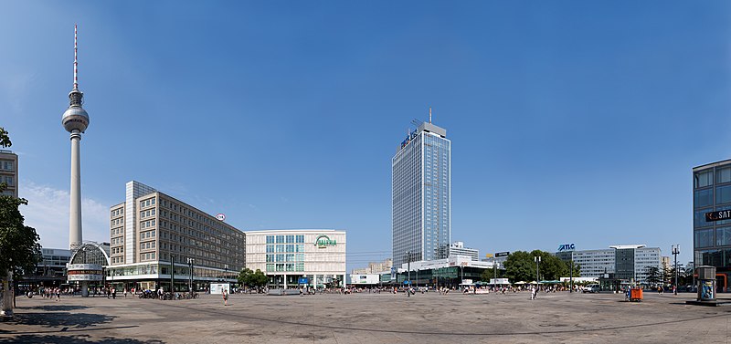
- Panoramic view of Alexanderplatz in 2015
- Street.caption
- Panoramic view of in 2015
- Street.namesake
- Alexander I of Russia
- Street.type
- Public square
- Street.location
- Berlin, Germany
- Street.quarter
- Mitte
- Street.inauguration_date
- <!--
via Wikipedia infobox
Wikidata facts
- Instance of
- tourist attraction
- Named after
- Alexander I of Russia
- Country
- Germany
- Located in
- Bezirk Mitte
- Location
- Berlin-Mitte
- Image
- Berlin - Alexanderplatz1.jpg
Show 6 more facts
- native label
- Alexanderplatz
- short name
- Alex
- Commons category
- Alexanderplatz (Berlin-Mitte)
- topic's main category
- Category:Alexanderplatz (Berlin-Mitte)
- Commons gallery
- Alexanderplatz
- different from
- Q15635027
Sources (3)
via Wikidata · CC0
~29 min read
Encyclopedic overview
21 sectionsContents
- History
- Early history to the 18th century
- {{lang|de|Königs Thor Platz|italic=no}} (1701–1805)
- {{lang|de|Alexanderplatz|italic=no}} (1805–1900)
- Between Empire and the Nazi era (1900–1940)
- Destruction of {{lang|de|Alexanderplatz|italic=no}} (1940–1945)
- Demolition and reconstruction (1945–1964)
- East Germany
- After German reunification (1989)
- 21st century
- Today and future plans
- Roads and public transport
- Structures
- World Clock
- Berolina
- Fountain of Friendship
- Other
- Image gallery
- References
- Further reading
- External links
thumbnail|right| at night in 2015 thumb|Neighborhoods in : [[Cölln|Old Cölln [1] (with Museum Island [1a], Fisher Island [1b]), [2] (with Nikolai Quarter [2a]), [3], [4], [5], [6], [7], (with ) [8], area ( and ) [9], [10] (with [10a]), [11], [12], [13] ]]
'''' (, Alexander Square'') is a large public square and transport hub in the central Mitte district of Berlin. The square is named after the Russian Tsar Alexander I, which also denotes the larger neighbourhood stretching from in the north-east to and the in the south-west.
Excerpted from Wikipedia’s “Alexanderplatz” article, available under the CC BY-SA 4.0 licence.