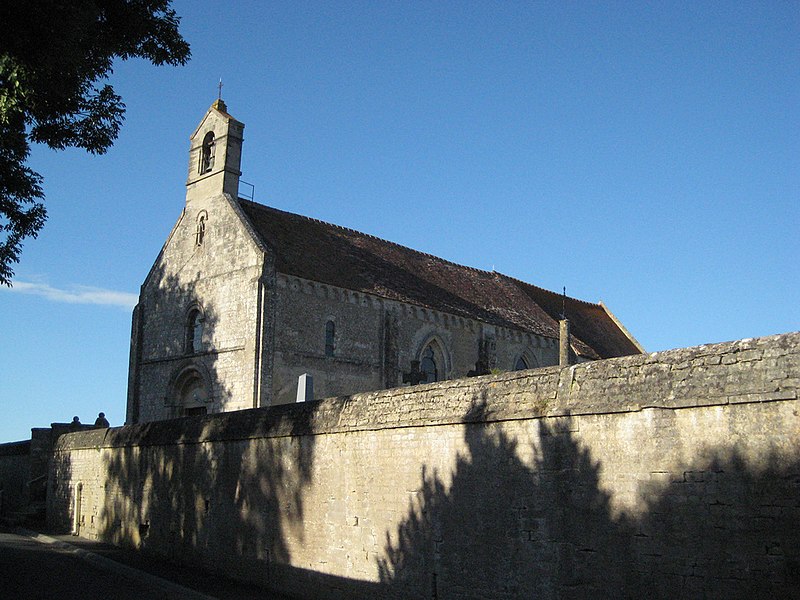
File:Anisy_eglise.jpg · Wikimedia Commons · See Wikimedia Commons
Anisy
Sign in to saveAnisy () is a commune in the Calvados department in the Normandy region of north-western France.
OverviewAI-generated
Anisy is a commune in France, situated within the canton of Creully, Calvados, and the arrondissement of Caen. It lies in the Normandy region and shares borders with Anguerny, Cairon, Cambes-en-Plaine, and Colomby-sur-Thaon. The official name of the locality is Anisy, and it is associated with the electoral district of the canton of Courseulles-sur-Mer.
The commune has an area of 4.19 square kilometers and an elevation above sea level of 67 meters. Its population is recorded as 819, comprising 350 males and 380 females. Anisy uses the postal code 14610 and operates in the Europe/Paris timezone.
Synthesized by Vinony from 46 facts across 7 sources: Wikidata, Open Meteo, Openweathermap, OpenStreetMap, GeoNames, Vinony graph, Geo. Generated from structured data (not the Wikipedia text) and checked against those facts — may still contain errors.
In the Vinony graph
The entry is geolocated on the map, across 3 mapped points.
Within Vinony's link graph, Anisy is referenced by 534 other articles, and connects out to France, time zone and geographic coordinate system.
It is catalogued under topics including Communes of Calvados (department) and Incomplete lists from April 2021.
Its subject is documented across 49 Wikipedia language editions.
Weather now
cached 23h ago7-day forecast
via Open-Meteo
Key facts
- French commune.name
- Anisy
- French commune.commune status
- Commune
- French commune.image
- Anisy eglise.jpg
- French commune.caption
- Church of Saint Peter
- French commune.image coat of arms
- Blason ville fr Anizy (Calvados).svg
- French commune.arrondissement
- Caen
- French commune.canton
- Courseulles-sur-Mer
- French commune.INSEE
- 14015
- French commune.postal code
- 14610
- French commune.mayor
- Nicolas Delahaye
- French commune.term
- 2020–2026
- French commune.intercommunality
- Cœur de Nacre
- French commune.elevation m
- 50
- French commune.elevation min m
- 44
- French commune.elevation max m
- 67
- French commune.area km2
- 4.19
via Wikipedia infobox
Wikidata facts
- Instance of
- commune of France
- Official name
- Anisy
- Country
- France
- Located in
- arrondissement of Caen
- Population
- 819
- Area
- 4.19
- Elevation
- 58
- Time zone
- UTC+02:00
- Shares border with
- Colomby-Anguerny
- Official website
- www.anisy.fr
- Image
- Anisy eglise.jpg
Show 8 more facts
- Commons category
- Anisy
- postal code
- 14610
- associated electoral district
- canton of Courseulles-sur-Mer
- male population
- 350
- female population
- 380
- P8168
- Infanta
- email address
- mailto:[email protected]
- phone number
- +33-2-31-44-14-98
via Wikidata · CC0
~2 min read
Encyclopedic overview
9 sectionsContents
- Geography
- History
- Heraldry
- Administration
- Population
- Sites and monuments
- Notable people linked to the commune
- See also
- References
Anisy () is a commune in the Calvados department in the Normandy region of north-western France.
==Geography== Anisy is located some 8 km north by north-west of Caen and 4 km south of Douvres-la-Délivrande. It can be accessed by the D79 road from Caen passing through the west of the commune and continuing to Anguerny. The village can be accessed by the D220 road from Mathieu in the east passing through the village and the commune and continuing to Villons-les-Buissons in the south-west. The D220A branches off the D220 in the village and goes south to Cambes-en-Plaine. The D141 from Mathieu to Anguerny also passes through the north-eastern tip of the commune. Apart from the village the commune is entirely farmland.
Excerpted from Wikipedia’s “Anisy” article, available under the CC BY-SA 4.0 licence.
Gallery (4)
On the map
3 mapped locations