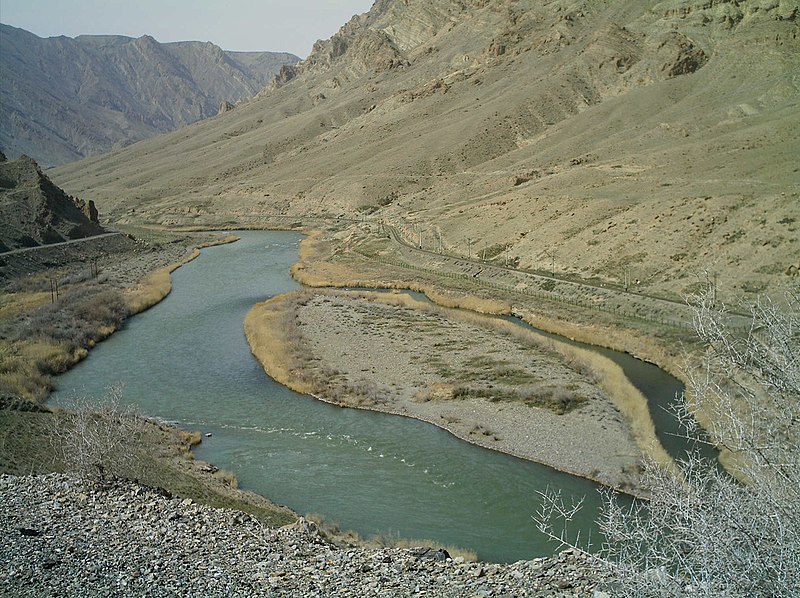
File:Jolfa-Aras2.jpg · Wikimedia Commons · See Wikimedia Commons
Aras River
Sign in to saveriver located in and along the countries of Turkey, Armenia, Azerbaijan, and Iran
The Aras River is a waterway that flows through and forms borders between Turkey, Armenia, Azerbaijan, and Iran in the South Caucasus region. It matters because it serves as an important geographic boundary and water resource for the four countries it touches.
AI-generated from the Wikipedia summary — may contain errors.
Wikidata facts
- Instance of
- river
- Country
- Azerbaijan
- Located in
- Syunik Province
- Continent
- Asia
- Image
- Армяно-Иранская граница 2024 1.jpg
- Length
- 1072
Show 10 more facts
- watershed area
- 102000
- discharge
- 285
- Commons category
- Aras River
- mouth of the watercourse
- Kura River
- category for the water basin
- Category:Araks Basin
- basin country
- Iran
- origin of the watercourse
- Bingöl Dağları
- native label
- Արաքս
- Commons gallery
- Aras River
- located in/on physical feature
- Armenian Highlands
Sources (6)
via Wikidata · CC0
~7 min read
Encyclopedic overview
The Aras is a transboundary river in the Caucasus. It rises in eastern Turkey and flows along the borders between Turkey and Armenia, between Turkey and the Nakhchivan exclave of Azerbaijan, between Iran and both Azerbaijan and Armenia, and, finally, through Azerbaijan where it flows into the Kura river as a right tributary. It drains the south side of the Lesser Caucasus Mountains, while the Kura drains the north side of the Lesser Caucasus. The river's total length is 1,072 km (666 mi) and its watershed covers an area of 102,000 km (39,000 mi). The Aras is one of the longest rivers in the Caucasus.
Names
Excerpted from Wikipedia’s “Aras River” article, available under the CC BY-SA 4.0 licence.
Gallery (11)
On the map
2 mapped locations
Available in 77 languages
- Español
- Français
- Deutsch
- 中文
- 日本語
- Русский
- Português
- Italiano
- العربية
- हिन्दी
- Afrikaans
- Amharic
- Armenian
- Asturian
- azb
- Azerbaijani
- Bahasa Indonesia
- Bangla
Show 58 more
- Bashkir
- Basque
- Belarusian
- Breton
- Bulgarian
- Catalan
- Cebuano
- Central Kurdish
- Chuvash
- Croatian
- Czech
- Danish
- Egyptian Arabic
- Esperanto
- Estonian
- Finnish
- Galician
- Georgian
- Greek
- Hausa
- Hebrew
- Hungarian
- hyw
- Javanese
- Kazakh
- Kotava
- Kurdish
- Kyrgyz
- Latin
- Latvian
- Lithuanian
- Macedonian
- Malayalam
- Mazanderani
- Mingrelian
- Nederlands
- Norwegian
- Norwegian Nynorsk
- Ossetic
- Polski
- Romanian
- Serbian
- Serbian (Latin)
- Slovak
- Slovenian
- Svenska
- Tajik
- Tatar
- Tiếng Việt
- Türkçe
- Ukrainian
- Upper Sorbian
- Urdu
- Uzbek
- Western Frisian
- Wu Chinese
- فارسی
- 한국어
via Wikidata sitelinks · CC0