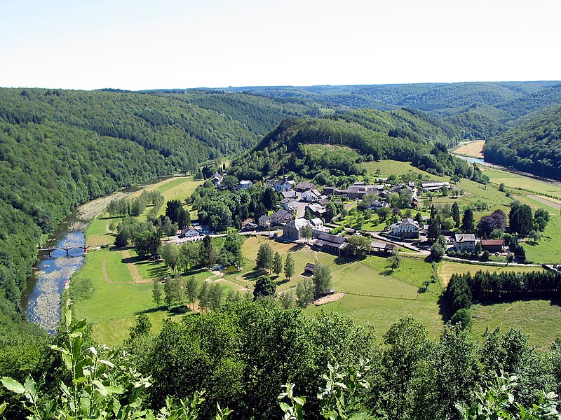
File:Frahan_JPG01.jpg · Wikimedia Commons · See Wikimedia Commons
Ardennes
Sign in to saveThe Ardennes, also known as the Ardennes Forest or Forest of Ardennes, is a region of extensive forests, rough terrain, rolling hills and ridges primarily in Belgium and Luxembourg, extending into Germany and France.
The Ardennes is a heavily forested region with rugged, hilly terrain that spans across Belgium, Luxembourg, Germany, and France. Its geographical features and strategic location have made it historically significant, particularly during major conflicts in European history.
AI-generated from the Wikipedia summary — may contain errors.
Key facts
- Forest.name
- Ardennes
- Forest.image
- Frahan JPG01.jpg
- Forest.image_caption
- Landscape of Frahan insidethe bend of the Semois
- Forest.location
- Wallonia, Belgium;Éislek, Luxembourg;Ardennes department and Grand Est region, France;Eifel, Germany
via Wikipedia infobox
Wikidata facts
- Demonym
- Ardenner
- Image
- Frahan JPG01.jpg
- Length
- 160
Show 2 more facts
- native label
- Ardennen
- Commons category
- Ardennes
Sources (3)
via Wikidata · CC0
~13 min read
Article
11 sectionsContents
- Geography
- High ranging summits
- Geology
- Economy
- Etymology
- History
- See also
- Notes
- References
- Sources
- External links
The Ardennes, also known as the Ardennes Forest or Forest of Ardennes, is a region of extensive forests, rough terrain, rolling hills and ridges primarily in Belgium and Luxembourg, extending into Germany and France.
Geologically, the range is a western extension of the Eifel; both were raised during the Givetian age of the Devonian (382.7 to 387.7 million years ago), as were several other named ranges of the same greater range.
Gallery (20)
On the map
3 mapped locations
Available in 75 languages
- Español
- Français
- Deutsch
- 中文
- 日本語
- Русский
- Português
- Italiano
- العربية
- Afrikaans
- Albanian
- Armenian
- Azerbaijani
- Bahasa Indonesia
- Basque
- be_x_old
- Belarusian
- Breton
Show 56 more
- Bulgarian
- Catalan
- Cebuano
- Colognian
- Croatian
- Czech
- Danish
- Egyptian Arabic
- Esperanto
- Estonian
- Finnish
- Georgian
- Greek
- Hebrew
- Hungarian
- Icelandic
- Interlingua
- Kazakh
- Latin
- Latvian
- Limburgish
- Lithuanian
- Lombard
- Luxembourgish
- Macedonian
- Malay
- Nederlands
- Norwegian
- Norwegian Nynorsk
- Occitan
- Pampanga
- Picard
- Polski
- Romanian
- Saterland Frisian
- Serbian
- Serbian (Latin)
- simple
- Slovak
- Slovenian
- Svenska
- Tamil
- Türkçe
- Ukrainian
- Walloon
- Waray
- Welsh
- West Flemish
- Western Frisian
- Western Panjabi
- Wu Chinese
- Zeelandic
- zh_yue
- فارسی
- ไทย
- 한국어
via Wikidata sitelinks · CC0