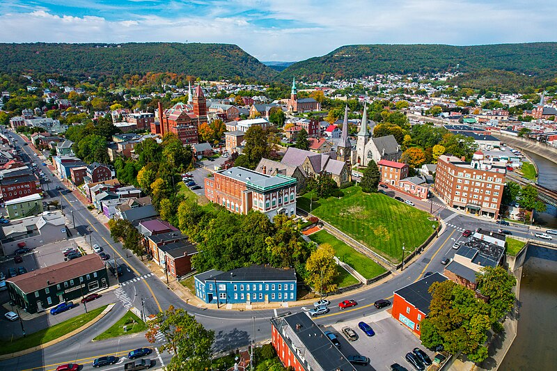
File:Cumberland_Aerial_2022.jpg · Wikimedia Commons · See Wikimedia Commons
Cumberland
Sign in to saveAlso known as Cumberland, Maryland, Cumberland, MD
city in Allegany County, Maryland, United States
Key facts
- Country
- United States
- State
- Maryland
- County
- Allegany
- Incorporated
- January 23, 1815
- Type
- Council-CEO
- Total
- 10.12 sq mi (26.22 km )
- Land
- 10.05 sq mi (26.04 km )
- Water
- 0.069 sq mi (0.18 km )
- Elevation
- 640 ft (200 m)
- Density
- 1,897/sq mi (732/km )
- Demonym
- Cumberlander
- Time zone
- UTC−5 (Eastern (EST))
- Summer dst
- UTC−4 (EDT)
- Zip codes
- 21501–21505
- Area codes
- 301, 240
- Fips code
- 24-21325
- Website
- www .cumberlandmd .gov
via Wikipedia infobox
Wikidata facts
- Instance of
- county seat
- Named after
- Prince William, Duke of Cumberland
- Official name
- Cumberland
- Country
- United States
- Located in
- Allegany County
- Population
- 19076
- Area
- 26.302081
- Elevation
- 191
- Capital of
- Allegany County
- Official website
- www.cumberlandmd.gov
- Image
- Cumberland Aerial 2022.jpg
- Households
- 8279
Show 14 more facts
- postal code
- 21505
- Commons category
- Cumberland, Maryland
- topic's main category
- Category:Cumberland, Maryland
- category of associated people
- Category:People from Cumberland, Maryland
- category for people born here
- Category:Births in Cumberland, Maryland
- inception
- 1787-00-00
- twinned administrative body
- Tapa Rural Municipality
- water as percent of area
- 0.7125
- different from
- Cumberland
- Köppen climate classification
- humid subtropical climate
- official map URL
- www.ci.cumberland.md.us/176/Maps-and-Imagery
- per capita income
- 25956
Sources (13)
via Wikidata · CC0
~25 min read
Encyclopedic overview
Cumberland is a city in Allegany County, Maryland, United States, and its county seat. The city had a population of 19,075 at the 2020 census. Located on the Potomac River, Cumberland is a regional business and commercial center for Western Maryland and the Potomac Highlands of West Virginia. It is the primary city of the Cumberland micropolitan area, which had 95,044 residents in 2020.
Historically, Cumberland was known as the "Queen City" as it was once the second largest in the state. Because of its strategic location on what became known as the Cumberland Road through the Appalachians, after the American Revolution it served as a historical outfitting and staging point for westward emigrant trail migrations throughout the first half of the 1800s. In this role, it supported the settlement of the Ohio Country and the lands in that latitude of the Louisiana Purchase. It also became an industrial center, served by major roads, railroads, and the Chesapeake and Ohio Canal, which connected Cumberland to Washington, D.C. and is now a national historical park. Interstate 68 bisects the town.
Excerpted from Wikipedia’s “Cumberland” article, available under the CC BY-SA 4.0 licence.