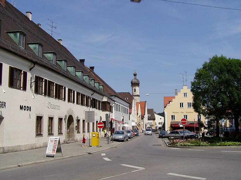
File:Grafing,_EBE_-_Marktpl_v_W.jpg · Wikimedia Commons · See Wikimedia Commons
Grafing
Sign in to saveAlso known as Grafing bei München, Grafing b.München
Grafing bei München (officially: Grafing b.München, , ) is a town in the district of Ebersberg, Upper Bavaria, Germany.
Key facts
- German location.state
- Bayern
- German location.type
- Stadt
- German location.name
- Grafing bei München
- German location.image_coa
- DEU Grafing bei München COA.svg
- German location.image_photo
- Grafing, EBE - Marktpl v W.jpg
- German location.image_caption
- Market square
- German location.image_plan
- Grafing bei München in EBE.svg
- German location.region
- Oberbayern
- German location.district
- Ebersberg
- German location.elevation
- 522
- German location.area
- 29.57
- German location.area_code
- 08092
- German location.licence
- EBE
- German location.Gemeindeschlüssel
- 09 1 75 122
- German location.website
- www.grafing.de
- German location.mayor
- Christian Bauer
- German location.leader_term
- 2020–26
- German location.party
- CSU
via Wikipedia infobox
Wikidata facts
- Official name
- Markt Grafing
- Country
- Germany
- Located in
- District of Ebersberg
- Population
- 14348
- Area
- 29.57
- Elevation
- 522
- Time zone
- UTC+02:00
- Shares border with
- Bruck
- Official website
- www.grafing.de
- Image
- Grafing - Marktplatz - geo-en.hlipp.de - 12869.jpg
- Dialing code
- 08092
- Licence plate code
- EBE
Show 5 more facts
- twinned administrative body
- Saint-Marcellin
- Commons category
- Grafing bei München
- postal code
- 85567
- hashtag
- GrafingBeiMünchen
Sources (11)
via Wikidata · CC0
~6 min read
Encyclopedic overview
15 sectionsContents
- Geography
- History
- Population
- Politics
- Coat of arms
- Education
- Schools
- Other educational institutions
- Sightseeing
- Sport clubs
- Pictures
- Twin towns
- Notable people
- References
- External links
Grafing bei München (officially: Grafing b.München, , ) is a town in the district of Ebersberg, Upper Bavaria, Germany.
==Geography== Grafing is in the Munich Region, about southeast of the state capital, where the Urtelbach and Wieshamer Bach both empty into the Attel River. The distance is roughly the same to Rosenheim and Wasserburg am Inn. Nearby municipalities are the district capital Ebersberg about to the north, Glonn and Kirchseeon.
Excerpted from Wikipedia’s “Grafing” article, available under the CC BY-SA 4.0 licence.
Gallery (17)
On the map
2 mapped locations