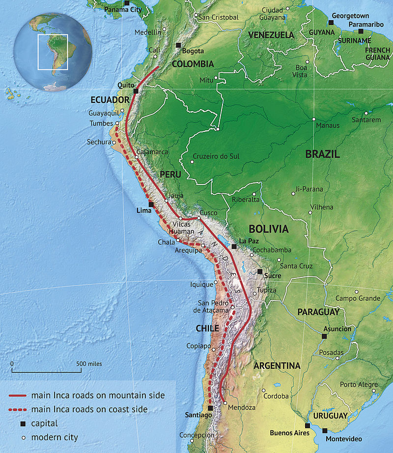
File:Inca_road_system.jpg · Wikimedia Commons · See Wikimedia Commons
Key facts
- Length
- 40,000 km (25,000 mi)
- Time period
- Pre-Columbian South America
- Official name
- Qhapaq Ñan, Andean Road System
- Criteria
- Cultural: ii, iii, iv, vi
- Inscription
- 2014 (38th Session )
- Area
- 3,642.8067 ha (9,001.571 acres)
- Buffer zone
- 728,448.256 ha (1,800,034.84 acres)
via Wikipedia infobox
Wikidata facts
- Instance of
- road network
- Country
- Bolivia
- Area
- 663069.68
- Image
- Qapaq Nan at Mosollaqta lake DSC 2822.jpg
- Length
- 40000
Show 5 more facts
- Commons category
- Inca road system
- heritage designation
- Tentative World Heritage Site
- Commons gallery
- Camino Inca
- native label
- Qhapaq Ñan
- time period
- Inca Empire
via Wikidata · CC0
~39 min read
Encyclopedic overview
The Inca road system (also spelled Inka road system and in Quechua: Qhapaq Ñan meaning "royal road") was the most extensive and advanced transportation system in pre-Columbian South America. It was about 40,000 kilometres (25,000 mi) long in total. The construction of the roads required a large expenditure of time and effort.
The network was composed of formal roads carefully planned, engineered, built, marked and maintained; paved where necessary, with stairways to gain elevation, bridges and accessory constructions such as retaining walls, and water drainage systems. It was based on two north–south roads: one along the coast and the second and most important inland and up the mountains, both with numerous branches. It can be directly compared with the road network built during the Roman Empire, although the Inca road system was built one thousand years later. The road system allowed for the transfer of information, goods, soldiers and persons, without the use of wheels, within the Tawantinsuyu or Inca Empire throughout a territory covering almost 2,000,000 km (770,000 sq mi) and inhabited by about 12 million people.
Excerpted from Wikipedia’s “Inca road system” article, available under the CC BY-SA 4.0 licence.