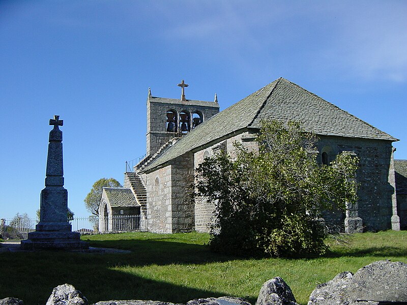
File:La_Trinitat.JPG · Wikimedia Commons · See Wikimedia Commons
OverviewAI-generated
La Trinitat is a commune in France, situated within the canton of Chaudes-Aigues and the arrondissement of Saint-Flour in the Cantal department. It is part of the Auvergne-Rhône-Alpes region and shares borders with Alpuech, Lacalm, Jabrun, and Saint-Urcize. The commune covers an area of 17.57 square kilometers and has an elevation of 1310 meters above sea level. Its postal code is 15110.
The population of La Trinitat is recorded as 118, with 26 males and 22 females. Another source lists the population as 64. The associated electoral district is the canton of Neuvéglise-sur-Truyère. A residential street named Rue des Fours is located in the commune.
Synthesized by Vinony from 34 facts across 6 sources: Wikidata, Openweathermap, OpenStreetMap, GeoNames, Vinony graph, Geo. Generated from structured data (not the Wikipedia text) and checked against those facts — may still contain errors.
In the Vinony graph
The entry is geolocated on the map.
Vinony's link graph records 255 inbound references to La Trinitat, and connects out to France, time zone and geographic coordinate system.
Vinony files it under Cantal communes articles needing translation from French Wikipedia, Communes of Cantal and Geography articles needing translation from French Wikipedia.
Vinony links it to 37 Wikipedia language editions.
Weather now
cached 10h agoPlace details
- Locality
- La Trinitat
- Region
- Auvergne-Rhône-Alpes
- Country
- France
- Population
- 64
via OpenStreetMap · GeoNames
Key facts
- Country
- France
- Region
- Auvergne-Rhône-Alpes
- Department
- Cantal
- Arrondissement
- Saint-Flour
- Canton
- Neuvéglise-sur-Truyère
- Mayor 2020 2026
- Frédéric Astruc
- Area
- 17.57 km (6.78 sq mi)
- Density
- 3.0/km (7.7/sq mi)
- Time zone
- UTC+01:00 ( CET )
- Summer dst
- UTC+02:00 ( CEST )
- Insee postal code
- 15241 /15110
- Elevation
- 1,035–1,310 m (3,396–4,298 ft) , (avg. 1,209 m or 3,967 ft)
via Wikipedia infobox
Wikidata facts
- Instance of
- commune of France
- Official name
- La Trinitat
- Country
- France
- Located in
- arrondissement of Saint-Flour
- Population
- 52
- Area
- 17.57
- Elevation
- 1167
- Time zone
- UTC+02:00
- Shares border with
- Argences en Aubrac
- Image
- La Trinitat.JPG
Show 8 more facts
- Commons category
- La Trinitat
- postal code
- 15110
- associated electoral district
- canton of Neuvéglise-sur-Truyère
- male population
- 26
- female population
- 22
- P8168
- Disney Channel Games
- email address
- mailto:[email protected]
- phone number
- +33-4-71-73-82-83
Sources (4)
via Wikidata · CC0
~1 min read
Encyclopedic overview
La Trinitat ( French pronunciation: [la tʁinita]) is a commune in the Cantal department in south-central France.
Population
Excerpted from Wikipedia’s “La Trinitat” article, available under the CC BY-SA 4.0 licence.