File:Basin_of_Mexico_1519_map-en.svg · Wikimedia Commons · See Wikimedia Commons
Lake Texcoco
Sign in to saveAlso known as Lago de Texcoco
former natural lake formation within the Valley of Mexico
Key facts
- Location
- Central Mexico
- Type
- Former pluvial and paleo salt lake , endorheic
- Surface area
- 5,400 square kilometres (2,100 sq mi)
- Max depth
- over 150 metres (490 ft)
- Surface elevation
- 2,240 metres (7,350 ft)
- Official name
- Lago de Texcoco
- Designated
- 5 June 2022
via Wikipedia infobox
Wikidata facts
- Instance of
- lake
- Country
- Mexico
- Area
- 2000
- Elevation
- 2236
- Image
- Lake Texcoco (Lago de Texcoco) December 1855 map from Harper's New Monthly Magazine Volume 12 December 1855 to May 1856 (IA harpersnew12harper) (page 34 crop).jpg
Show 1 more fact
- Commons category
- Texcoco Lake, Mexico
Sources (1)
via Wikidata · CC0
~13 min read
Encyclopedic overview
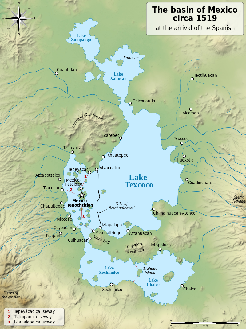
Lake Texcoco (Spanish: Lago de Texcoco; Nahuatl languages: Tetzco(h)co) was a natural saline lake within the Anahuac or Valley of Mexico. Lake Texcoco is best known for an island situated on the western side of the lake where the Mexica built the city of Mēxihco Tenōchtitlan, which would later become the capital of the Aztec Empire. After the Spanish conquest, efforts to control flooding led to most of the lake being drained.
The entire lake basin is now almost completely occupied by Mexico City, the capital of the present-day nation of Mexico. Drainage of the lake has led to serious ecological and human consequences. The local climate and water availability have changed considerably, contributing to water scarcity in the area; subsequent groundwater extraction leads to land subsidence under much of the city. Native species endemic to the lake region, such as the axolotl, have become severely endangered or extinct due to ecosystem change.
Excerpted from Wikipedia’s “Lake Texcoco” article, available under the CC BY-SA 4.0 licence.