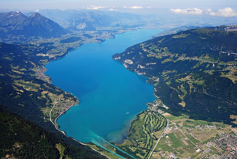
File:Aerial_image_of_Lake_Thun_(view_from_the_east).jpg · Wikimedia Commons · See Wikimedia Commons
In the Vinony graph
Vinony's link graph records 159 inbound references to Lake Thun, and connects out to Spiez, discharge and Switzerland.
The entry is geolocated on the map in BE.
Vinony files it under Aare basin, Bernese Oberland and Lakes of Switzerland.
Vinony links it to 42 Wikipedia language editions.
Key facts
- Location
- Canton of Bern
- Type
- freshwater fjord , recent regulation
- Primary inflows
- Aare , Kander
- Primary outflows
- Aare
- Catchment area
- 2,500 km (970 sq mi)
- Basin countries
- Switzerland
- Max length
- 17.5 km (10.9 mi)
- Max width
- 3.5 km (2.2 mi)
- Surface area
- 48.3 km (18.6 sq mi)
- Average depth
- 136 m (446 ft)
- Max depth
- 217 m (712 ft)
- Water volume
- 6.5 km (5,300,000 acre⋅ft)
- Residence time
- 684 days
- Surface elevation
- 558 m (1,831 ft)
- Settlements
- Thun , Spiez , Faulensee
via Wikipedia infobox
Wikidata facts
- Instance of
- lake
- Named after
- Thun
- Country
- Switzerland
- Located in
- Canton of Berne
- Area
- 43.80
- Elevation
- 558
- Image
- Aerial image of Lake Thun (view from the east).jpg
- Width
- 3.5
- Length
- 17.5
Show 12 more facts
- Commons category
- Lake Thun
- inflows
- Aare
- outflows
- Aare
- topic's main category
- Category:Lake Thun
- watershed area
- 2500
- vertical depth
- 217
- mountain range
- Alps
- drainage basin
- Rhine basin
- volume as quantity
- 6500
- basin country
- Switzerland
- native label
- Thunersee
- P8168
- Blace
Sources (2)
via Wikidata · CC0
~2 min read
Encyclopedic overview
Lake Thun (German: Thunersee, Swiss Standard German pronunciation: [ˈtuːnərˌzeː]) is an Alpine lake in the Bernese Oberland in Switzerland named after the city of Thun, on its northern shore. At 48.3 km (18.6 sq mi) in surface area, it is the largest Swiss lake entirely within a single canton.
The lake was created after the last glacial period. After the 10th century, it split from Lake Brienz, before which the two lakes were combined, as Wendelsee ("Lake Wendel"). The culminating point of the lake's drainage basin is the Finsteraarhorn at 4,274 metres (14,022 ft) above sea level.
Excerpted from Wikipedia’s “Lake Thun” article, available under the CC BY-SA 4.0 licence.