File:Chocolate_Hills_overview.JPG · Wikimedia Commons · See Wikimedia Commons
landform
Sign in to saveAlso known as geographic feature, land form
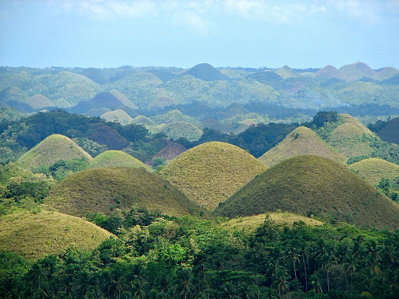
thumb|The Chocolate Hills constitute a landform.
A landform is a natural physical feature of the Earth's surface, such as hills, mountains, valleys, or plains. Understanding landforms matters because they shape how landscapes look, influence where people can live and farm, and affect water flow and weather patterns across regions.
AI-generated from the Wikipedia summary — may contain errors.
Wikidata facts
- Subclass of
- geographical feature
- Part of
- landscape
- Image
- Dunes of Algeria.jpg
Show 8 more facts
- studied by
- Earth science
- topic's main category
- Category:Landforms
- has characteristic
- relative direction
- equivalent class
- id.oclc.org/worldcat/entity/Q340
- Commons category
- Landforms
- on focus list of Wikimedia project
- Wikipedia:Vital articles/Level/4
- Wikidata usage instructions
- Los ejemplos de esta clase son accidentes geográficos reales, como el monte Everest, y no tipos de accidentes geográficos, como los glaciares.
- model item
- Mount Everest
Sources (3)
via Wikidata · CC0
~5 min read
Encyclopedic overview
8 sectionsContents
- Physical characteristics
- Hierarchy of classes
- Recent developments
- See also
- References
- Sources
- Further reading
- External links
thumb|The Chocolate Hills constitute a landform.
A landform is a land feature on the solid surface of the Earth or other planetary body. They may be natural or may be anthropogenic (caused or influenced by human activity). Landforms together make up a given terrain, and their arrangement in the landscape is known as topography. Landforms include hills, mountains, canyons, and valleys, as well as shoreline features such as bays, peninsulas, and seas, including submerged features such as mid-ocean ridges, volcanoes, and the great oceanic basins.
Excerpted from Wikipedia’s “landform” article, available under the CC BY-SA 4.0 licence.
Gallery (10)
Available in 67 languages
- Español
- Français
- Deutsch
- 中文
- 日本語
- Русский
- Português
- العربية
- हिन्दी
- Asturian
- Azerbaijani
- Bahasa Indonesia
- Bangla
- Bashkir
- Basque
- Bhojpuri
- Bikol
- Breton
Show 48 more
- Bulgarian
- Catalan
- Central Kurdish
- Cornish
- Czech
- Danish
- Esperanto
- Estonian
- Filipino
- Finnish
- Galician
- Georgian
- Guarani
- Hebrew
- Icelandic
- Ido
- Javanese
- Kazakh
- Kikuyu
- Latin
- Macedonian
- Malay
- Mazanderani
- Nederlands
- Norwegian
- Norwegian Nynorsk
- Oromo
- Polski
- Punjabi
- Romanian
- Scots
- Serbian
- simple
- Sinhala
- Slovenian
- Svenska
- Tamil
- Tatar
- Tiếng Việt
- Türkçe
- Ukrainian
- Welsh
- Western Frisian
- zh_min_nan
- zh_yue
- فارسی
- ไทย
- 한국어
via Wikidata sitelinks · CC0