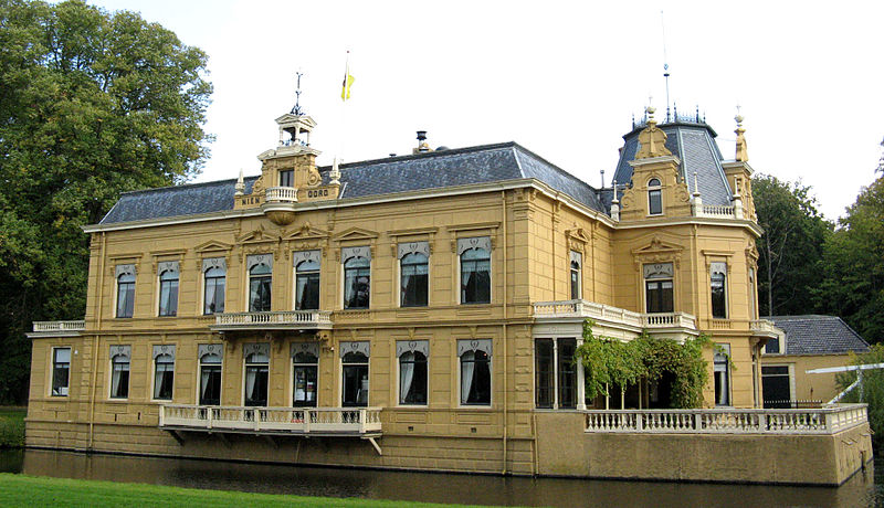
File:Borg_Nienoord.jpg · Wikimedia Commons · See Wikimedia Commons
Leek
Sign in to saveformer municipality in the province of Groningen, the Netherlands
Key facts
- Country
- Netherlands
- Province
- Groningen
- Municipality
- Westerkwartier
- Total
- 6.17 km (2.38 sq mi)
- Elevation
- 2 m (6.6 ft)
- Density
- 1,810/km (4,690/sq mi)
- Demonym
- Leekster
- Time zone
- UTC+1 ( CET )
- Summer dst
- UTC+2 ( CEST )
- Postcode
- 9350–9351
- Area code
- 0594
via Wikipedia infobox
Wikidata facts
- Instance of
- municipality of the Netherlands
- Demonym
- Leekster
- Country
- Netherlands
- Located in
- Groningen
- Population
- 3216
- Area
- 64.28
- Elevation
- 2
- Time zone
- UTC+01:00
- Shares border with
- Zuidhorn
- Official website
- www.leek.nl
- Image
- Borg Nienoord.jpg
- Households
- 7951
- Dialing code
- 0594
Show 4 more facts
- Commons category
- Leek, Groningen
- postal code
- 9827–9829
- topic's main category
- Category:Leek, Groningen
Sources (8)
via Wikidata · CC0
~3 min read
Encyclopedic overview
Duch topographic map of the municipality of Leek, Groningen, as per June 2015 Leek ( Dutch: [leːk] ; Gronings: De Laik; West Frisian: De Like) is a village and former municipality in Groningen province in the northeastern Netherlands. The municipality, which bordered the Drenthe and Friesland provinces, was merged into the municipality of Westerkwartier on 1 January 2019.
The village of Leek is approximately 20 km west of Groningen (city) on the A7 (E22) highway.
Excerpted from Wikipedia’s “Leek” article, available under the CC BY-SA 4.0 licence.