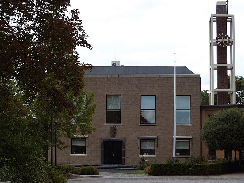
File:Marum_Townhall.JPG · Wikimedia Commons · See Wikimedia Commons
Marum
Sign in to saveAlso known as Gemeente Marum
Marum () is a town and a former municipality in the northeastern Netherlands. The municipality was merged into the municipality of Westerkwartier on 1 January 2019.
Key facts
- Settlement.name
- Marum
- Settlement.settlement_type
- Town and former municipality
- Settlement.image_skyline
- Marum Townhall.JPG
- Settlement.image_caption
- Marum town hall
- Settlement.image_flag
- Flag of Marum.svg
- Settlement.flag_size
- 100x67px
- Settlement.image_shield
- Marum wapen.svg
- Settlement.shield_size
- 100x80px
- Settlement.image_map
- Map - NL - Municipality code 0025 (2009).svg
- Settlement.map_alt
- Highlighted position of Marum in a municipal map of Groningen
- Settlement.map_caption
- Location in Groningen
- Settlement.pushpin_map
- Netherlands Groningen#Netherlands
- Settlement.pushpin_mapsize
- 250
- Settlement.pushpin_map_caption
- Location in the province of Groningen in the Netherlands
- Settlement.subdivision_type
- Country
- Settlement.subdivision_type1
- Province
- Settlement.subdivision_type2
- Municipality
- Settlement.subdivision_name2
- 23px Westerkwartier
via Wikipedia infobox
Wikidata facts
- Instance of
- municipality of the Netherlands
- Named after
- Marum
- Country
- Netherlands
- Located in
- Groningen
- Population
- 1396
- Area
- 64.88
- Elevation
- 3
- Time zone
- UTC+01:00
- Shares border with
- Smallingerland
- Official website
- www.marum.nl
- Image
- Marum Townhall.JPG
- Households
- 4123
Show 4 more facts
- postal code
- 9824–9826
- Commons category
- Marum
- topic's main category
- Category:Marum
- different from
- Marum
Sources (6)
via Wikidata · CC0
~1 min read
Encyclopedic overview
6 sectionsContents
- History
- Former population centres
- Notable people
- Gallery
- References
- External links
Marum () is a town and a former municipality in the northeastern Netherlands. The municipality was merged into the municipality of Westerkwartier on 1 January 2019.
== History == Marum is located in the peat area, and was an agricultural village. It was first mentioned in 1385 and probably means village near the lake. In 1795, it was home to 351 people.
Excerpted from Wikipedia’s “Marum” article, available under the CC BY-SA 4.0 licence.
Gallery (10)
On the map
3 mapped locations