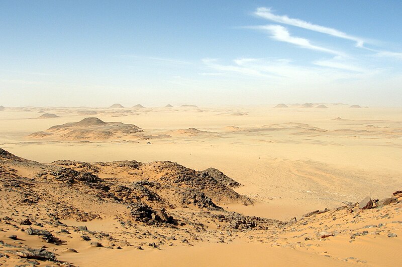
File:Libyandesertcscott.jpg · Wikimedia Commons · See Wikimedia Commons
Pustynia Libijska
Sign in to savenortheastern part of the Sahara comprising desert areas in Egypt, Libya and Sudan
The Libyan Desert is a vast sandy region that covers parts of Egypt, Libya, and Sudan in the northeastern Sahara. It matters as one of the world's largest desert expanses, shaping the geography, climate, and human settlement patterns across North Africa.
AI-generated from the Wikipedia summary — may contain errors.
Wikidata facts
- Instance of
- desert
- Part of
- Sahara
- Has part
- Western Desert
- Country
- Sudan
- Located in
- Butnan District
- Area
- 1100000
- Elevation
- 1024
- Image
- Libyan Desert - 2006.jpg
- Width
- 1000
Show 2 more facts
- Commons category
- Libyan Desert
- lowest point
- Qattara Depression
Sources (1)
via Wikidata · CC0
Article · Polski
Pustynia Libijska – pustynia we wschodniej części Sahary, położona we wschodniej Libii, zachodnim Egipcie i północno-zachodnim Sudanie. Dla części położonej na terenie Egiptu używa się nazwy Pustynia Zachodnia. Jej powierzchnia wynosi ok. 2 mln km². W większości piaszczysta (wydmy wysokości do 300 m). Klimat zwrotnikowy skrajnie suchy. Dobowe wahania temperatury do 30 °C. Roczna suma opadów poniżej 10 mm na południu (na północy ok. 100 mm). Eksploatacja bogatych złóż ropy naftowej w Libii. Jej północno-zachodnią część stanowi Sarir Kalansziju.
Abstract from DBpedia / Wikipedia · CC BY-SA
Gallery (4)
On the map
Available in 63 languages
- Español
- Français
- Deutsch
- 中文
- 日本語
- Русский
- Português
- Italiano
- العربية
- हिन्दी
- Albanian
- Armenian
- Azerbaijani
- Bahasa Indonesia
- Basque
- be_x_old
- Belarusian
- Bulgarian
Show 44 more
- Catalan
- Cebuano
- Chuvash
- Corsican
- Croatian
- Czech
- Danish
- Egyptian Arabic
- Esperanto
- Estonian
- Finnish
- Galician
- Georgian
- Hausa
- Hebrew
- Hungarian
- Ido
- Interlingua
- Kazakh
- Kyrgyz
- Latvian
- Lithuanian
- Malay
- Mingrelian
- Nederlands
- Norwegian
- Polski
- Romanian
- Scottish Gaelic
- Serbian
- Serbian (Latin)
- simple
- Slovak
- Slovenian
- Svenska
- Tajik
- Türkçe
- Ukrainian
- Uzbek
- Waray
- Welsh
- Wu Chinese
- فارسی
- 한국어
via Wikidata sitelinks · CC0