
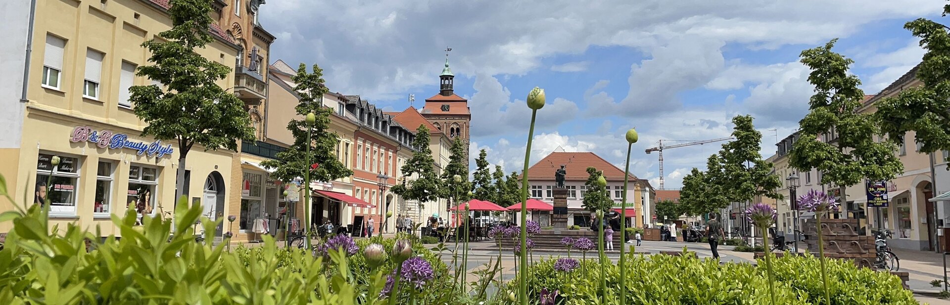
File:Luckenwalde_tower_church.jpg · Wikimedia Commons · See Wikimedia Commons
Luckenwalde
Sign in to saveLuckenwalde (; Upper and , , ) is the capital of the Teltow-Fläming district in the state of Brandenburg in eastern Germany. It is situated on the Nuthe river north of the Fläming Heath, at the eastern rim of the Nuthe-Nieplitz Nature Park, about south of Berlin. The town area includes the villages of Frankenfelde and Kolzenburg.
Key facts
- German location.type
- Stadt
- German location.image_coa
- Wappen Luckenwalde.png
- German location.image_photo
- Luckenwalde tower church.jpg
- German location.image_caption
- Market tower and St. John's Church
- German location.image_plan
- Luckenwalde in TF.png
- German location.state
- Brandenburg
- German location.district
- Teltow-Fläming
- German location.elevation
- 48
- German location.area
- 46.61
- German location.postal_code
- 14943
- German location.area_code
- 03371
- German location.licence
- TF
- German location.Gemeindeschlüssel
- 12 0 72 232
- German location.divisions
- 3 Ortsteile
- German location.website
- www.luckenwalde.de
- German location.mayor
- Elisabeth Herzog-von der Heide
- German location.leader_term
- 2017–25
- German location.party
- SPD
via Wikipedia infobox
Official website
Startseite / Luckenwalde
luckenwalde.de →Link to the official site · 6,234 chars · not written by Vinony
Wikidata facts
- Population
- 21000
- Area
- 46.61
- Elevation
- 48
- Official website
- www.luckenwalde.de
- Image
- Luckenwalde tower church.jpg
- Dialing code
- 03371
Show 4 more facts
- Commons category
- Luckenwalde
- postal code
- 14943
- Commons gallery
- Luckenwalde
- hashtag
- Luckenwalde
Sources (7)
via Wikidata · CC0
~5 min read
Article
8 sectionsContents
- Overview
- Demography
- Politics
- Transport
- Notable people
- International relations
- References
- External links
Luckenwalde (; Upper and , , ) is the capital of the Teltow-Fläming district in the state of Brandenburg in eastern Germany. It is situated on the Nuthe river north of the Fläming Heath, at the eastern rim of the Nuthe-Nieplitz Nature Park, about south of Berlin. The town area includes the villages of Frankenfelde and Kolzenburg.
==Overview== thumb|left|Former hat factory
Gallery (10)
On the map
2 mapped locations