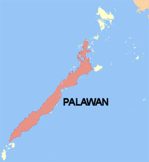
File:Palawan_island_map.PNG · Wikimedia Commons · See Wikimedia Commons
Key facts
- Location
- Southeast Asia
- Archipelago
- Philippine Islands
- Adjacent to
- South China Sea Sulu Sea
- Area
- 12,188.6 km (4,706.0 sq mi)
- Area rank
- 64th
- Length
- 425 km (264.1 mi)
- Width
- 40 km (25 mi)
- Coastline
- 1,354.1 km (841.4 mi)
- Highest elevation
- 2,086 m (6844 ft)
- Highest point
- Mount Mantalingajan
- Region
- Mimaropa
- Province
- Palawan
- Municipalities
- List Aborlan Bataraza Brooke's Point Dumaran El Nido Narra Puerto Princesa Quezon Rizal Roxas San Vicente Sofronio Española Taytay
- Capital and largest city
- Puerto Princesa (pop. 316,384)
- Population
- 1,023,849 (2024)
- Pop density
- 72.7/km (188.3/sq mi)
via Wikipedia infobox
Wikidata facts
- Instance of
- island
- Country
- Philippines
- Located in
- Palawan
- Continent
- Asia
- Population
- 886308
- Area
- 12189
- Elevation
- 2085
- Body of water
- South China Sea
- Highest point
- Mount Mantalingajan
- Image
- Sabang, South China Sea, Palawan, Philippines.jpg
Show 1 more fact
- Commons category
- Palawan (island)
via Wikidata · CC0
~12 min read
Encyclopedic overview
Palawan (Spanish: Isla de La Paragua) is the largest island of the province of Palawan in the Philippines and fifth-largest by area and tenth-most populous island of the country, with a total population of 1,023,849 as of 2024 census. The northwest coast of the island is along the Palawan Passage in the eastern South China Sea, while the southeast coast forms part of the northern limit of the Sulu Sea. Much of the island remains traditional and is considered by some as under-developed. Abundant wildlife, jungle mountains, and some white sandy beaches attract many tourists, as well as international companies looking for development opportunities.
One city and 12 out of the 23 municipalities of the Province of Palawan are on this island. Iwahig Prison and Penal Farm, one of seven operating units of the Bureau of Corrections, is located on the island.
Excerpted from Wikipedia’s “Palawan” article, available under the CC BY-SA 4.0 licence.