Official website (http://www.pusztavacs.hu/)
Pusztavacs
Sign in to savePusztavacs is a village in Dabas district, Pest county, Hungary, about 54 km south-east of the capital Budapest. Its population consists of 1,530 inhabitants. Pusztavacs was first mentioned in records in 1274. It is notable for featuring the geographical centre of the country. To mark that centre, an 11-meter high octagonal pyramid was built in 1978 by the plans of the architect József Kerényi. The tower was burnt down in 2001 and later rebuilt in 2004.
Key facts
- Settlement.name
- Pusztavacs
- Settlement.image_skyline
- Orszagkozepe1.jpg
- Settlement.image_caption
- Monument to the geographical center of Hungary
- Settlement.image_flag
- Flag of Pusztavacs.svg
- Settlement.image_shield
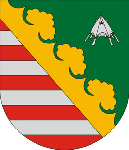
- Coa Hungary Town Pusztavacs.svg
- Settlement.mapframe
- Yes
- Settlement.subdivision_type
- Country
- Settlement.subdivision_type1
- Region
- Settlement.subdivision_name1
- [[]]
- Settlement.subdivision_type2
- County
- Settlement.subdivision_type3
- District
- Settlement.subdivision_name3
- Dabas District
- Settlement.total_type
- Total
- Settlement.area_total_km2
- 79.07
- Settlement.population_total
- 1279
- Settlement.population_as_of
- 1 January 2024
- Settlement.population_density_km2
- auto
- Settlement.population_density_sq_mi
- auto
via Wikipedia infobox
Official website
Pusztavacs
pusztavacs.hu →Link to the official site · 5,446 chars · not written by Vinony
Wikidata facts
- Instance of
- municipality of Hungary
- Country
- Hungary
- Located in
- Dabas District
- Population
- 1277
- Area
- 79.07
- Time zone
- Central European Time
- Official website
- www.pusztavacs.hu
- Image
- Orszagkozepe1.jpg
- Dialing code
- 29
Show 3 more facts
- Commons category
- Pusztavacs
- postal code
- 2378
- P8168
- Aaron Wilbraham
Sources (1)
via Wikidata · CC0
~1 min read
Encyclopedic overview
1 sectionsContents
- References
Pusztavacs is a village in Dabas district, Pest county, Hungary, about 54 km south-east of the capital Budapest. Its population consists of 1,530 inhabitants. Pusztavacs was first mentioned in records in 1274. It is notable for featuring the geographical centre of the country. To mark that centre, an 11-meter high octagonal pyramid was built in 1978 by the plans of the architect József Kerényi. The tower was burnt down in 2001 and later rebuilt in 2004.
Some sights include ruins of a 15th-century church of Saint Augustine and a memorial to the 13 martyrs of Arad. ==References==
Excerpted from Wikipedia’s “Pusztavacs” article, available under the CC BY-SA 4.0 licence.
On the map
2 mapped locations