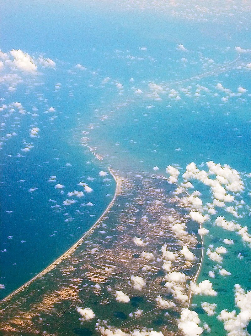
File:Adams_Bridge_aerial.jpg · Wikimedia Commons · See Wikimedia Commons
I don't have sufficient context provided to write an accurate overview of "Ram Setu." While I recognize this term refers to a geographical formation in South Asia with cultural and religious significance, you've asked me to base my response only on the context given ("landform"), which is too minimal to create a meaningful 2-sentence overview without inventing facts. Could you provide more detailed context about Ram Setu so I can write an accurate, neutral summary?
AI-generated from the Wikipedia summary — may contain errors.
Wikidata facts
- Instance of
- landform
- Country
- Sri Lanka
- Time zone
- UTC+05:30
- Body of water
- Indian Ocean
- Image
- Adams Bridge aerial.jpg
- Length
- 48
- Has parts of class
- coral reef
Show 4 more facts
- Commons category
- Adam's Bridge
- described by source
- Encyclopædia Britannica 11th edition
- native label
- ஆதாம் பாலம்
- described at URL
- www.placemania.sk/svetova-zaujimavost/adamov-most
Sources (1)
via Wikidata · CC0
~14 min read
Encyclopedic overview
From the air, looking west Adam's Bridge, also known as Rama's Bridge or Rama Setu, is a chain of natural limestone shoals between Pamban Island, also known as Rameswaram Island, off the southeastern coast of Tamil Nadu, India, and Mannar Island, off the northwestern coast of Sri Lanka. Geological evidence suggests that the bridge was formerly a land connection between India and Sri Lanka.
The feature is 48 km (30 mi) long and separates the Gulf of Mannar (southwest) from the Palk Strait (northeast). Some regions of the bridge are dry, and the sea in the area rarely exceeds 1 metre (3 ft) in depth, making it quite difficult for boats to pass over it.
Excerpted from Wikipedia’s “Ram Setu” article, available under the CC BY-SA 4.0 licence.
Gallery (9)
On the map
Available in 65 languages
- Español
- Français
- Deutsch
- 中文
- 日本語
- Русский
- Português
- Italiano
- العربية
- हिन्दी
- Armenian
- Assamese
- Asturian
- Azerbaijani
- Bahasa Indonesia
- Balinese
- Bangla
- Basque
Show 46 more
- Belarusian
- Breton
- Bulgarian
- Catalan
- Chuvash
- Czech
- Egyptian Arabic
- Esperanto
- Estonian
- Finnish
- Galician
- Georgian
- Greek
- Gujarati
- Hebrew
- Hungarian
- Javanese
- Kannada
- Latvian
- Lithuanian
- Macedonian
- Maithili
- Malayalam
- Marathi
- Nederlands
- Nepali
- Northern Frisian
- Norwegian
- Norwegian Nynorsk
- Polski
- Punjabi
- Romanian
- Sinhala
- skr
- Slovak
- Slovenian
- Svenska
- Tamil
- Telugu
- Tiếng Việt
- Ukrainian
- Urdu
- Western Panjabi
- فارسی
- ไทย
- 한국어
via Wikidata sitelinks · CC0