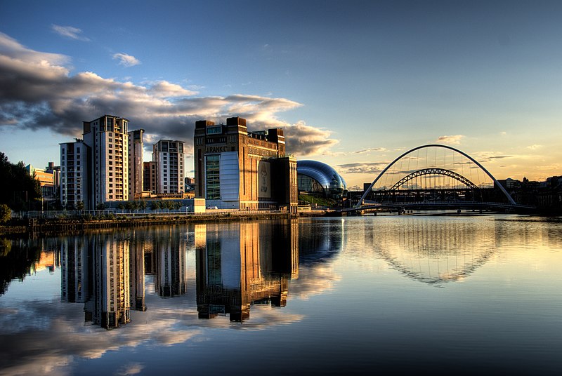
File:Newcastle_Quayside_with_bridges.jpg · Wikimedia Commons · See Wikimedia Commons
Key facts
- Country
- United Kingdom
- Constituent country
- England
- County
- Cumbria Northumberland Tyne and Wear
- Source
- South Tyne
- Location
- Alston Moor , Cumbria , England
- 2nd source
- North Tyne
- Mouth
- Tynemouth
- Length
- 118 km (73 mi)
- Basin size
- 2,933 km (1,132 sq mi)
- Average
- 44.6 m /s (1,580 cu ft/s)
- Left
- River Derwent , River Team , River Don
- Right
- Ouse Burn
via Wikipedia infobox
Wikidata facts
- Instance of
- river
- Official name
- River Tyne
- Country
- United Kingdom
- Located in
- Tyne and Wear
- Continent
- Europe
- Image
- Newcastle Upon Tyne bridges.jpg
- Length
- 100
Show 8 more facts
- native label
- River Tyne
- described by source
- Granat Encyclopedic Dictionary
- mouth of the watercourse
- North Sea
- Commons category
- River Tyne, England
- topic's main category
- Category:River Tyne
- watershed area
- 2145
- origin of the watercourse
- River South Tyne
- P12749
- Klaus Auhuber
Sources (3)
via Wikidata · CC0
~10 min read
Encyclopedic overview
The Gateshead Millennium Bridge for pedestrians and cyclists and the Tyne Bridge for vehicles in the background in Newcastle upon Tyne Confluence of North (right) and South Tyne (left) near Warden The River Tyne /ˈtaɪn/ is a river in North East England. Its length (excluding tributaries) is 73 miles (118 km). It is formed by the North Tyne and the South Tyne, which converge at Warden near Hexham in Northumberland at a place dubbed 'The Meeting of the Waters'.
The Tyne Rivers Trust measure the whole Tyne catchment as 2,936 km (1,134 square miles), containing 4,399 km (2,733 miles) of waterways.
Excerpted from Wikipedia’s “River Tyne” article, available under the CC BY-SA 4.0 licence.