File:Tiel_waterpoort_C.jpg · Wikimedia Commons · See Wikimedia Commons
Tiel
Sign in to save270px|thumb|Dutch Topographic map of Tiel (town), as of March 2014 Tiel () is a municipality and a town in the middle of the Netherlands. The town is enclosed by the Waal river and the Linge river to the South and the North, and the Amsterdam-Rhine Canal to the East. Tiel comprises the population centres Kapel-Avezaath, Tiel and Wadenoijen. The city was founded in the 5th century CE.
Key facts
- Settlement.name
- Tiel
- Settlement.settlement_type
- Municipality
- Settlement.image_skyline
- Tiel waterpoort C.jpg
- Settlement.image_caption
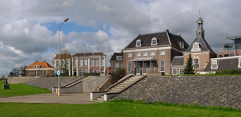
- Fortified dyke in Tiel
- Settlement.image_flag
- Flag of Tiel.svg
- Settlement.flag_size
- 100x67px
- Settlement.image_shield
- Coat of arms of Tiel.svg
- Settlement.shield_size
- 100x80px
- Settlement.image_map
- Map - NL - Municipality code 0281 (2009).svg
- Settlement.map_alt
- Highlighted position of Tiel in a municipal map of Gelderland
- Settlement.map_caption
- Location in Gelderland
- Settlement.pushpin_map
- Netherlands#Europe
- Settlement.pushpin_map_caption
- Location within the Netherlands##Location within Europe
- Settlement.pushpin_relief
- 1
- Settlement.subdivision_type
- Country
- Settlement.subdivision_name
- Netherlands
- Settlement.subdivision_type1
- Province
- Settlement.subdivision_name1
- Gelderland
via Wikipedia infobox
Official website

Link to the official site · 2,712 chars · not written by Vinony
Wikidata facts
- Instance of
- municipality of the Netherlands
- Demonym
- Tielenaar
- Country
- Netherlands
- Located in
- Gelderland
- Population
- 41920
- Area
- 32.63
- Elevation
- 7
- Time zone
- UTC+01:00
- Body of water
- Amsterdam–Rhine Canal
- Shares border with
- Geldermalsen
- Official website
- www.tiel.nl
- Image
- Tiel City Walls West.JPG
- Households
- 17212
- Dialing code
- 0344
Show 10 more facts
- postal code
- 4013–4014
- topic's main category
- Category:Tiel
- Commons category
- Tiel
- category for people born here
- Category:Births in Tiel
- contains settlement
- Kerk-Avezaath
- category of associated people
- Category:People from Tiel
- email address
- mailto:[email protected]
- described by source
- Encyclopædia Britannica 11th edition
- phone number
- +31344637111
- P8168
- Gardon
Sources (15)
via Wikidata · CC0
~5 min read
Encyclopedic overview
9 sectionsContents
- The town of Tiel
- Ancient history
- Notable people
- Public service
- The arts
- Sport
- Gallery
- References
- External links
270px|thumb|Dutch Topographic map of Tiel (town), as of March 2014 Tiel () is a municipality and a town in the middle of the Netherlands. The town is enclosed by the Waal river and the Linge river to the South and the North, and the Amsterdam-Rhine Canal to the East. Tiel comprises the population centres Kapel-Avezaath, Tiel and Wadenoijen. The city was founded in the 5th century CE.
== The town of Tiel == Chartered in 1200, the town of Tiel is known for its medieval ports, market town, and became a member of the Hanseatic League.
Excerpted from Wikipedia’s “Tiel” article, available under the CC BY-SA 4.0 licence.
Gallery (21)
On the map
3 mapped locations