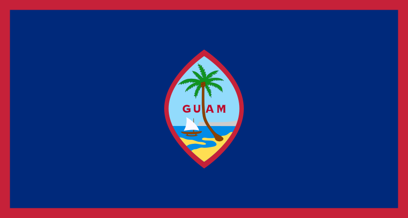
File:Flag_of_Guam.svg · Wikimedia Commons · See Wikimedia Commons
Guam
Sign in to saveAlso known as GU, Territory of Guam, US-GU, GUM, Guåhån, Guahan, ISO 3166-1:GU, Guåhan
Guam ( ; ) is an island that is an organized, unincorporated territory of the United States in the Micronesia subregion of the western Pacific Ocean. Guam's capital is Hagåtña, and the most populous village is Dededo. It is the westernmost point and territory of the United States, as measured from the geographic center of the U.S. with point Udall. In Oceania, Guam is the largest and southernmost of the Mariana Islands and the largest island in Micronesia. In 2022, its population was 168,801. Chamorros are its largest ethnic group, but a minority on the multiethnic island. The territory spans
Guam is an organized, unincorporated U.S. territory located in the western Pacific Ocean that serves as America's westernmost point. It is the largest island in Micronesia and has strategic importance to the United States as a Pacific territory, with a population of approximately 168,801 people as of 2022.
AI-generated from the Wikipedia summary — may contain errors.
Key facts
- Dependency.name
- Guam
- Dependency.settlement_type
- Unincorporated and organized U.S. territory
- Dependency.image_flag
- Flag of Guam.svg
- Dependency.flag_size
- 130px
- Dependency.flag_link
- Flag of Guam
- Dependency.image_seal
- Seal of Guam.svg
- Dependency.seal_size
- 65px
- Dependency.seal_type
- Seal
- Dependency.seal_link
- Seal of Guam
- Dependency.nickname
- ()
- Dependency.nickname_link
- List of U.S. state and territory nicknames
- Dependency.motto_link
- List of U.S. state and territory mottos
- Dependency.motto
- ()
- Dependency.anthem_link
- List of U.S. state songs
- Dependency.anthem
- "Kantikun Guåhan" (Chamorro)("Guam Hymn") (regional) "The Star-Spangled Banner" (official)
- Dependency.image_map
- Guam_in_United_States.svg
- Dependency.map_alt
- Location of Guam
- Dependency.map_caption
- Location of Guam (circled in red)
via Wikipedia infobox
Research
2,162 papers- Guam dementia syndrome revisited in 2011.ReviewCurrent opinion in neurology · 2011Lee SEDOI: 10.1097/WCO.0b013e32834cd50a
- Ancient DNA from Guam and the peopling of the Pacific.Proceedings of the National Academy of Sciences of the United States of America · 2021Pugach I, Hübner A, Hung HC et al.DOI: 10.1073/pnas.2022112118
- Nursing Leadership in Guam.Nursing administration quarterly · 2019Hattori-Uchima M, Wood KDOI: 10.1097/NAQ.0000000000000332
- Guam: The US territory where America's day begins but abortion access is still in the dark.Contraception · 2021Raidoo S, Kaneshiro B, Stowers PDOI: 10.1016/j.contraception.2021.03.030
- The ALS/PDC syndrome of Guam and the cycad hypothesis.ReviewNeurology · 2008Steele JC, McGeer PLDOI: 10.1212/01.wnl.0000312571.81091.26
- Guam ALS-PDC: possible causes.Science (New York, N.Y.) · 1993Spencer PS, Kisby GE, Ross SM et al.DOI: 10.1126/science.8235599
- Guam ALS-PDC: possible causes.Science (New York, N.Y.) · 1993Sacks OWDOI: 10.1126/science.8235600
- Amyotrophic lateral sclerosis and parkinsonism-dementia complex on Guam: immunohistochemical studies.ReviewThe Keio journal of medicine · 1992Hirano ADOI: 10.2302/kjm.41.6
via PubMed
Wikidata facts
- Official name
- Guåhan
- Demonym
- guamanienne
- Country
- Spanish Empire
- Located in
- United States
- Contains
- Agana Heights
- Continent
- Oceania
- Capital
- Hagåtña
- Official language
- Chamorro
- Currency
- United States dollar
- Population
- 153836
- Area
- 544.0
- Time zone
- UTC+10:00
- Body of water
- Pacific Ocean
- Head of government
- Lou Leon Guerrero
- Legislature
- Legislature of Guam
- Anthem
- Stand Ye Guamanians
- Shares border with
- Federated States of Micronesia
- Highest point
- Mount Lamlam
- Official website
- guam.gov
- Image
- Guam satellite photo map.jpg
- Life expectancy
- 79.575
- Nominal GDP
- 6123000000
- Calling code
- +1671
- Mains voltage
- 110
Show 41 more facts
- Motto
- Tånó I' Man CHamoru
- Flag
- flag of Guam
- Unicode character
- 🇬🇺
- twinned administrative body
- Riga
- topic's main Wikimedia portal
- Portal:Guam
- geography of topic
- geography of Guam
- top-level Internet domain
- .gu
- Commons category
- Guam
- topic's main category
- Category:Guam
- inception
- 1898-01-01
- category for people born here
- Category:Births in Guam
- category of associated people
- Category:Guamanian people
- driving side
- right
- Commons gallery
- Guam
- emergency phone number
- 911
- short name
- GU
- language used
- Chamorro
- total fertility rate
- 2.386
- related category
- Category:Guam-related lists
- described by source
- New International Encyclopedia
- lowest point
- Pacific Ocean
- history of topic
- history of Guam
- category for people who died here
- Category:Deaths in Guam
- water as percent of area
- 63.23
- foundational text
- Guam Organic Act of 1950
- minimum temperature record
- 56
- official symbol
- Guam Rail
- maximum temperature record
- 96
- native label
- Guåhan
- economy of topic
- economy of Guam
- demographics of topic
- demographics of Guam
- nickname
- Tånó y CHamoru
- marriageable age
- 18
- topic has template
- Template:Guam
- OpenStreetMap zoom level
- 10
- official map URL
- gis.guam.gov/gmap/index.html
- different from
- GUAM Organization for Democracy and Economic Development
- P11012
- Louis-Philippe I
- on focus list of Wikimedia project
- Wikipedia:Vital articles/Level/4
- P12749
- red giant
- P8168
- Boulzicourt
Sources (15)
via Wikidata · CC0
~44 min read
Encyclopedic overview
30 sectionsContents
- History
- Pre-Contact era
- Spanish era
- American era
- World War I
- World War II
- Post-war
- Geography and environment
- Climate
- Ecology
- Demographics
- Culture
- Sports
- Economy
- Tourism
- Budget and unemployment
- Pacific migration to Guam
- Military bases
- Government and politics
- Political status
- Villages
- Transportation and communications
- Education
- Health care
- See also
- Notes
- References
- Works cited
- Further reading
- External links
Guam ( ; ) is an island that is an organized, unincorporated territory of the United States in the Micronesia subregion of the western Pacific Ocean. Guam's capital is Hagåtña, and the most populous village is Dededo. It is the westernmost point and territory of the United States, as measured from the geographic center of the U.S. with point Udall. In Oceania, Guam is the largest and southernmost of the Mariana Islands and the largest island in Micronesia. In 2022, its population was 168,801. Chamorros are its largest ethnic group, but a minority on the multiethnic island. The territory spans and has a population density of .
Indigenous Guamanians are the Chamorro, who are related to the Austronesian peoples of the Malay Archipelago, the Philippines, Taiwan, and Polynesia. Unlike most of its neighbors, the Chamorro language is not classified as a Micronesian or Polynesian language. Like Palauan, it possibly constitutes an independent branch of the Malayo-Polynesian language family. The Chamorro people settled Guam and the Mariana islands approximately 3,500 years ago. Portuguese explorer Ferdinand Magellan, while in the service of Spain, was the first European to visit and claim the island in March 1521. Guam was fully colonized by Spain in 1668. Between the 17th and 19th centuries, Guam was an important stopover for Spanish Manila galleons. During the Spanish–American War, the United States captured Guam in June 1898. Under the 1898 Treaty of Paris, Spain ceded Guam to the U.S. effective April 11, 1899.
Excerpted from Wikipedia’s “Guam” article, available under the CC BY-SA 4.0 licence.
Gallery (52)
On the map
3 mapped locations
Available in 165 languages
- Español
- Français
- Deutsch
- 中文
- 日本語
- Русский
- Português
- Italiano
- العربية
- हिन्दी
- Achinese
- Afrikaans
- Albanian
- Albanian
- Amharic
- ami
- Angika
- Aragonese
Show 146 more
- Armenian
- Arpitan
- Asturian
- azb
- Azerbaijani
- Bahasa Indonesia
- Balinese
- Bangla
- Bashkir
- Basque
- Bavarian
- be_x_old
- Belarusian
- Bikol
- Bishnupriya
- Bosnian
- Breton
- Bulgarian
- Burmese
- Catalan
- cdo
- Cebuano
- Central Kurdish
- Chamorro
- Chechen
- Cheyenne
- Cornish
- Croatian
- Czech
- Danish
- Divehi
- Egyptian Arabic
- Esperanto
- Estonian
- Extremaduran
- Faroese
- Fiji Hindi
- Filipino
- Finnish
- fiu_vro
- Gagauz
- Galician
- gcr
- Georgian
- Gilaki
- Greek
- Haitian Creole
- Hakka Chinese
- Hausa
- Hebrew
- Hungarian
- Icelandic
- Ido
- Iloko
- Interlingua
- Irish
- Javanese
- Kannada
- Kara-Kalpak
- Kazakh
- kge
- Khmer
- Kinyarwanda
- Kyrgyz
- Ladino
- Lao
- Latin
- Latvian
- Ligurian
- Limburgish
- Lingua Franca Nova
- Lithuanian
- lld
- Luxembourgish
- Macedonian
- Malagasy
- Malay
- Malayalam
- Manx
- Māori
- Marathi
- Mazanderani
- Mingrelian
- Mongolian
- Nederlands
- Nepali
- Newari
- Northern Frisian
- Norwegian
- Norwegian Nynorsk
- Occitan
- Old English
- Ossetic
- Pampanga
- Papiamento
- Picard
- Piedmontese
- Polski
- Punjabi
- Quechua
- Romanian
- Samoan
- Santali
- Sardinian
- Scots
- Serbian
- Serbian (Latin)
- Shan
- Shona
- Sicilian
- Silesian
- simple
- Sinhala
- Slovak
- Slovenian
- Somali
- Sundanese
- Svenska
- Swahili
- Tajik
- Tamil
- Tatar
- Telugu
- Tiếng Việt
- Toki Pona
- Tongan
- Türkçe
- Turkmen
- Ukrainian
- Urdu
- Uyghur
- Uzbek
- Waray
- Welsh
- Western Frisian
- Western Panjabi
- Wolof
- Wu Chinese
- Yakut
- Yoruba
- Zaza
- zh_min_nan
- zh_yue
- فارسی
- ไทย
- 한국어
via Wikidata sitelinks · CC0