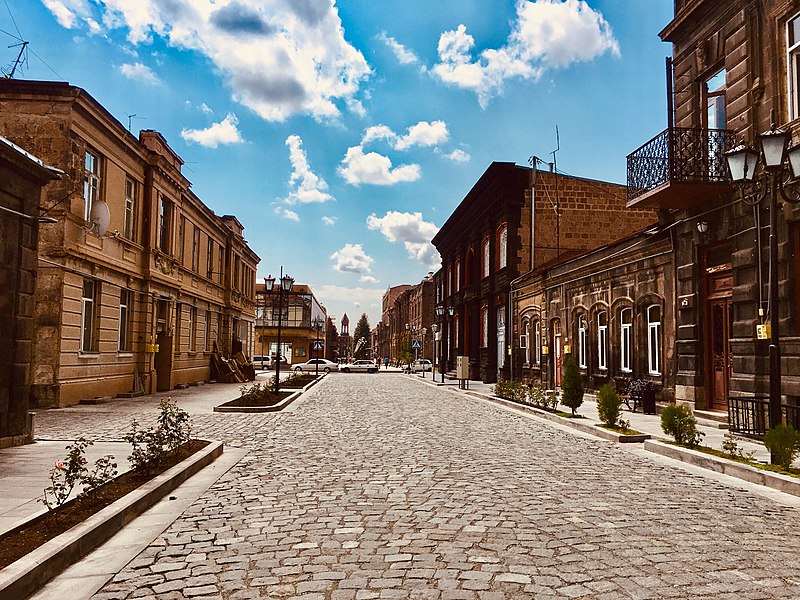
File:Abovyan_street_Gyumri.jpg · Wikimedia Commons · See Wikimedia Commons
Gyumri
Sign in to saveAlso known as Gümrü, Alexandropol
Gyumri (, ) is an urban municipal community and the second-largest city in Armenia, serving as the administrative center of Shirak Province in the northwestern part of the country. By the end of the 19th century, when the city was known as Alexandropol, it became the largest city of Russian-ruled Eastern Armenia with a population above that of Yerevan. The city became renowned as a cultural hub, while also carrying significance as a major center of Russian troops during Russo-Turkish wars of the 19th century.
Gyumri is Armenia's second-largest city and the administrative center of Shirak Province in the country's northwestern region. Historically known as Alexandropol, it was the largest city in Russian-ruled Eastern Armenia by the late 1800s and became an important cultural hub and military center for Russian forces during conflicts with the Ottoman Empire.
AI-generated from the Wikipedia summary — may contain errors.
Key facts
- Settlement.official_name
- Gyumri
- Settlement.native_name
- Գյումրի
- Settlement.native_name_lang
- hy
- Settlement.settlement_type
- City and urban community
- Settlement.nickname
- Hayrakaghak ("Father-city")
- Settlement.image_caption
- From top down, left to right;Abovyan street view • City Hall • Cathedral of Gyumri • Dzitoghtsyan Museum of National Architecture • Independence Square • Gyumri skyline
- Settlement.imagesize
- 300px
- Settlement.image_flag
- File:Flag of Gyumri.svg
- Settlement.image_seal
- File:Coat of arms of Gyumri.svg
- Settlement.pushpin_map
- Armenia#Shirak
- Settlement.mapsize
- 150px
- Settlement.map_caption
- Location of Gyumri in Armenia
- Settlement.subdivision_type
- Country
- Settlement.subdivision_name
- Armenia
- Settlement.subdivision_type1
- Province
- Settlement.subdivision_name1
- Shirak
- Settlement.government_type
- Mayor–council
- Settlement.leader_title
- Mayor
via Wikipedia infobox
Described at
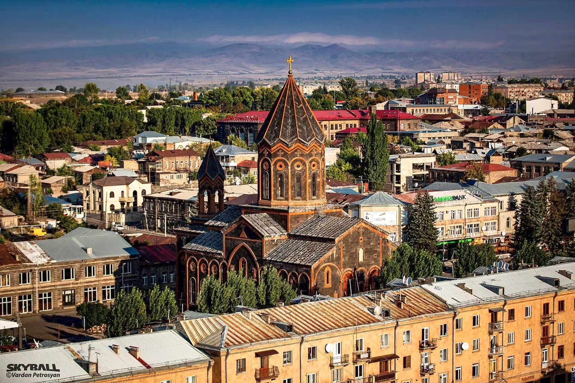
Gjumri a Spitak - Arménsko - PlaceMania
Zemetrasenie pri Spitaku z 7. decembra 1988 zničilo Gjumri a pripravilo o život desaťtisíce ľudí.
placemania.sk →Mesto Gjumri dostalo svoje meno až začiatkom 90. rokov. V cárskych časoch bolo známe ako Alexandropol, za Sovietov, keď bolo druhým najväčším mestom a dôležitým priemyselným centrom Arménskej sovietskej socialistickej republiky, zase ako Leninakan. Potom prišlo 7. decembra 1988 zemetrasenie s epicentrom neďaleko Spitaku, ktoré celú oblasť zdevastovalo. Zahynulo pri ňom 25 000 až 50 000 ľudí, nespočetne veľa sa ich zranilo a v mrazivej zime prišlo o strechu nad hlavou. V tejto zúfalej situácii požiadal ZSSR o pomoc aj zahraničie. Počet obetí katastrofy skončil taký vysoký aj z toho dôvodu, že panelové obytné domy typické pre Brežnevovu éru boli do takejto oblasti náchylnej na zemetrasenia absolútne nevhodné. Budovy zo stalinistickej éry utrpeli oveľa menšie škody a robustné kamenné stavby z cárskych čias si počínali ešte lepšie. V Gjumri dodnes nájdete ruiny po zemetrasení, hoci sa mesto od tejto udalosti výrazne postavilo na nohy. Zrekonštruoval sa napríklad aj Kostol svätého Spasiteľa, čo padol za obeť tejto katastrofe. Epicentrum zemetrasenia v roku 1988 sa nachádzalo neďaleko mestečka Spitak, ktoré ostalo kompletne zrovnané so zemou a prišlo o tretinu obyvateľstva. Tamojší cintorín je plný obetí tejto tragédie a dodnes ju tiež pripomína provizórna kaplnka z vlnitého plechu. Zakladateľ projektu PlaceMania.sk a zodpovedá za jeho obsah, technické fungovanie a dlhodobý rozvoj. Cestovné zápisky na webe vychádzajú z vlastnej skúsenosti z ciest; faktografické záznamy o miestach vznikajú kombináciou verejných zdrojov, automatizovaného spracovania dát a redakčného overovania. Zameriava sa na netradičné lokality, ich historický a geografický kontext a menej známe súvislosti. Things to do near Gjumri a Spitak, Gyumri, Kumayri, Leninakan, Ալեքպոլ, Ալեքսանդրաբոլ, Գիմրի, Lokalita, Politická oblasť, locality, political, Gjumri, Shirak Province, Armenia, Hayastan, Arménsko. Find tours, guided tours, local activities, attractions, tickets, excursions, sightseeing, day trips and travel experiences nearby. Coordinates: 40.7929026, 43.8464971. Dedina Tsovagyugh pri jazere Sevan je známa cestnými predajcami rýb, ktorých v chladnom počasí zastupujú figuríny. Múzeum etikiet Matchbox v arménskom Tumanyane vystavuje viac ako 10 000 etikiet zo zápalkových škatuliek z celého sveta. Reštaurácia Tsaghkunk v arménskej dedine Tsaghkunk vznikla z bývalej sovietskej jedálne a ukrýva pod sklom dva toniry z 11. storočia. Ruiny kláštora Kobayr s gruzínskymi nápismi a freskami ležia nad roklinou pri hlavnej ceste. Pozrite si ďalšie zaujímave miesta vo svete, ktoré stoja za naplánovanie ďalšej cesty. Ďalšie stretnutie s ruskými vojakmi, ale stále sú neoblomní. Pod ich drobnohľadom frčíme turecko-arménskou hranicou. Tento malý stredoveký kostolík ukrytý v centre Jerevanu bol stratený a znovuobjavený - dvakrát. Na ostrove Tinian stojí jediný kamenný stĺp vysoký 4,5 metra – posledný zvyšok megalitického Domu Taga. Nikto dodnes presne nevie,… Chcete vidieť ďalšie úchvatné miesta ako Gjumri a Spitak? Nájdeš ich u nás na mape. Objav s nami ďalšie úžasné miesta na zemi.
Excerpt from a page describing this subject · 16,574 chars · not written by Vinony
Wikidata facts
- Instance of
- big city
- Named after
- Cimmerians
- Official name
- Լենինական
- Country
- Soviet Union
- Official language
- Armenian
- Population
- 121976
- Area
- 46.2
- Elevation
- 1509
- Time zone
- UTC+04:00
- Official website
- gyumricity.am
- Image
- Gyumri (historical center).jpg
- Dialing code
- 312
- Licence plate code
- 45 am
Show 16 more facts
- twinned administrative body
- Halle (Saale)
- Commons category
- Gyumri
- topic's main category
- Category:Gyumri
- category for people born here
- Category:Births in Gyumri
- category of associated people
- Category:People from Gyumri
- described by source
- Granat Encyclopedic Dictionary
- Commons gallery
- Gyumri
- postal code
- 3101–3126
- native label
- Գյումրի
- P8168
- Jenny Erpenbeck
- time of earliest written record
- 0401-00-00
- category for honorary citizens of entity
- Q32417205
- P12749
- Pskov
- different from
- Alexandroupolis
- number of viewers/listeners
- 502498
- described at URL
- www.placemania.sk/svetova-zaujimavost/gjumri-a-spitak
Sources (9)
via Wikidata · CC0
~42 min read
Encyclopedic overview
34 sectionsContents
- Name
- History
- Classical antiquity and the ancient Armenian Kingdom
- Medieval period
- Persian and Russian rules
- Modern history
- Geography and climate
- Demographics
- Population
- Religion
- Culture
- Museums and art
- Music
- Films
- Monuments
- Local customs
- Media
- Transportation
- Air transportation
- Railway
- Public vans and taxis
- Economy
- Education
- Sport
- Football
- Futsal
- Olympic individual sports
- Twin towns – sister cities
- People
- See also
- Notes
- References
- Bibliography
- External links
Gyumri (, ) is an urban municipal community and the second-largest city in Armenia, serving as the administrative center of Shirak Province in the northwestern part of the country. By the end of the 19th century, when the city was known as Alexandropol, it became the largest city of Russian-ruled Eastern Armenia with a population above that of Yerevan. The city became renowned as a cultural hub, while also carrying significance as a major center of Russian troops during Russo-Turkish wars of the 19th century.
The city underwent a tumultuous period during and after World War I. While Russian forces withdrew from the South Caucasus due to the October Revolution, the city became host to large numbers of Armenian refugees fleeing the Armenian genocide, in particular hosting 22,000 orphaned children in around 170 orphanage buildings. It was renamed Leninakan during the Soviet period and became a major industrial and textile center in Soviet Armenia. The city's population rapidly grew to above 200,000 prior to the 1988 Spitak earthquake, when it was devastated, with the city's population being reduced to 121,976 as of the 2011 census. The city was renamed Gyumri under modern independent Armenia soon after the breakup of the Soviet Union, and post-earthquake reconstruction efforts continue. As of the 2022 census, the population of the city was 112,301.
Excerpted from Wikipedia’s “Gyumri” article, available under the CC BY-SA 4.0 licence.
Gallery (52)
On the map
3 mapped locations
Available in 86 languages
- Español
- Français
- Deutsch
- 中文
- 日本語
- Русский
- Português
- Italiano
- العربية
- Afrikaans
- Armenian
- Asturian
- Avaric
- azb
- Azerbaijani
- Bahasa Indonesia
- Basque
- be_x_old
Show 67 more
- Belarusian
- Bulgarian
- Catalan
- Cebuano
- Central Kurdish
- Chechen
- Chuvash
- Croatian
- Czech
- Danish
- Egyptian Arabic
- Esperanto
- Estonian
- Finnish
- Georgian
- Greek
- Hebrew
- Hungarian
- hyw
- Interlingua
- kai
- Kazakh
- Kurdish
- Kyrgyz
- Latin
- Latvian
- Lithuanian
- Malay
- Malayalam
- Mari
- Mazanderani
- Mingrelian
- Mongolian
- Nederlands
- Northern Frisian
- Norwegian
- Norwegian Nynorsk
- Ossetic
- Polski
- Punjabi
- Romanian
- Scots
- Serbian
- Serbian (Latin)
- Sicilian
- Silesian
- simple
- Sinhala
- Slovenian
- Svenska
- Swahili
- Tatar
- Tiếng Việt
- Türkçe
- Ukrainian
- Upper Sorbian
- Urdu
- Uzbek
- Veps
- Waray
- Western Frisian
- Wu Chinese
- zh_min_nan
- zh_yue
- فارسی
- ไทย
- 한국어
via Wikidata sitelinks · CC0