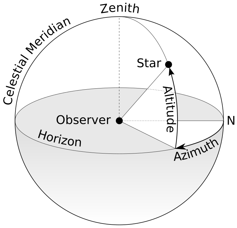
File:Azimuth-Altitude_schematic.svg · Wikimedia Commons · See Wikimedia Commons
horizontal coordinate system
Sign in to saveAlso known as az/el system, Alt/Az system, altazimuth system, Alt-Az System, El-Az System
type of celestial coordinate system that uses the observer's local horizon as the fundamental plane
Wikidata facts
- Subclass of
- astronomical coordinate system
- Image
- Azimuth-Altitude schematic.svg
Show 2 more facts
- Commons category
- Horizontal coordinate system
- topic's main category
- Category:Horizontal coordinate system
Sources (1)
via Wikidata · CC0
~5 min read
Encyclopedic overview
Horizontal coordinates use a celestial sphere centered on the observer. Azimuth is measured eastward from the north point (sometimes from the south point) of the horizon; altitude is the angle above the horizon.
The horizontal coordinate system is a celestial coordinate system that uses the observer's local horizon as the fundamental plane to define two angles of a spherical coordinate system: altitude and azimuth. Therefore, the horizontal coordinate system is sometimes called the az/el system, the alt/az system, or the alt-azimuth system, among others. In an altazimuth mount of a telescope, the instrument's two axes follow altitude and azimuth.
Excerpted from Wikipedia’s “horizontal coordinate system” article, available under the CC BY-SA 4.0 licence.