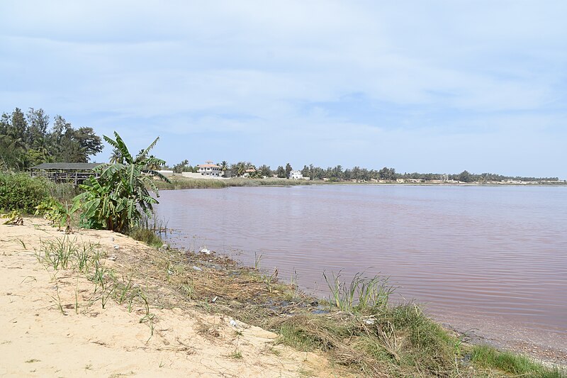
File:RetbaLakeShore.jpg · Wikimedia Commons · See Wikimedia Commons
In the Vinony graph
Within Vinony's link graph, Lake Retba is referenced by 26 other articles, and connects out to Senegal, Atlantic Ocean and energy.
The entry is geolocated on the map in waterbody.
It sits within the topics Lakes of Senegal and Saline lakes of Africa.
Its subject is documented across 37 Wikipedia language editions.
Key facts
- Location
- Cap Vert Peninsula
- Type
- Hypersaline lake
- Basin countries
- Senegal
- Surface area
- 3 km (1.2 sq mi)
- Max depth
- 3 metres (9.8 ft)
via Wikipedia infobox
Wikidata facts
- Instance of
- tourist attraction
- Country
- Senegal
- Area
- 3
- Elevation
- 0
- Image
- Ngeej bu Retba.jpg
- Width
- 1
- Length
- 3.85
- Has use
- extraction of salt
Show 5 more facts
- Commons category
- Lac rose (Senegal)
- heritage designation
- Tentative World Heritage Site
- vertical depth
- 3
- salinity
- 400
- product or material produced
- table salt
Sources (3)
via Wikidata · CC0
~4 min read
Encyclopedic overview
Cap Vert peninsula (NASA, 22 Nov. 2004) Lac Rose in Senegal Lake Retba, also known as Lac Rose (meaning "pink lake"), lies north of the Cape Verde peninsula in Senegal, some 35 km (22 mi) north-east of the capital, Dakar. It is named for its pink waters caused by Dunaliella salina algae and is known for its high salt content, up to 40% in some areas. Its colour is usually particularly strong from late January to early March, during the dry season. Flooding in September 2022 not only disrupted salt harvesting activities on the lake, but also led the lake to lose its colour, causing a negative effect on tourism. However, as of 2025, the lake has regained some of its colour.
The lake is, as of May 2026, under consideration by UNESCO as a World Heritage Site.
Excerpted from Wikipedia’s “Lake Retba” article, available under the CC BY-SA 4.0 licence.