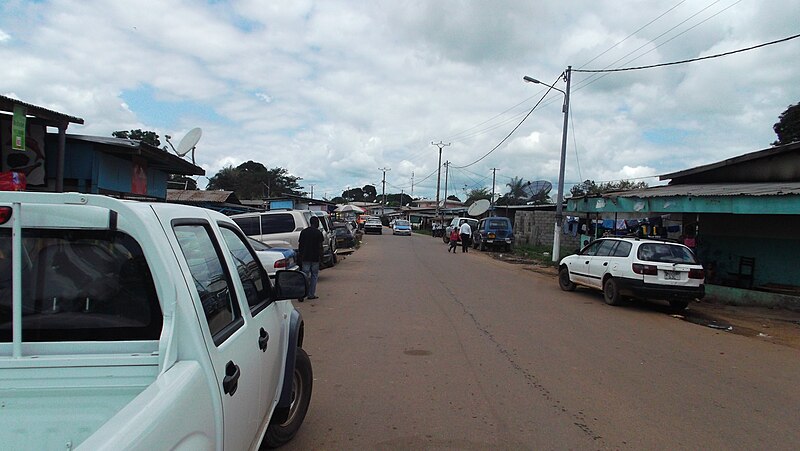
File:Lambarene1.JPG · Wikimedia Commons · See Wikimedia Commons
Lambaréné
Sign in to saveAlso known as Lambarene
Lambaréné is a town and the capital of Moyen-Ogooué in Gabon. It has a population of 38,775 as of 2013, and is located 75 kilometres south of the equator.
Key facts
- Settlement.official_name
- Lambaréné
- Settlement.image_skyline
- Lambarene1.JPG
- Settlement.image_caption
- Street in Lambaréné
- Settlement.image_shield
- Coat of arms of Lambaréné, Gabon.svg
- Settlement.pushpin_map
- Gabon
- Settlement.pushpin_label_position
- bottom
- Settlement.pushpin_map_caption
- Location in Gabon
- Settlement.subdivision_type
- Country
- Settlement.subdivision_type1
- Province
- Settlement.subdivision_name1
- Moyen-Ogooué
- Settlement.subdivision_type2
- Department
- Settlement.unit_pref
- Imperial
- Settlement.population_as_of
- 2013 census
- Settlement.population_total
- 38,775
- Settlement.population_blank1_title
- Ethnicities
- Settlement.population_blank2_title
- Religions
via Wikipedia infobox
Wikidata facts
- Country
- Gabon
- Located in
- Moyen-Ogooué Province
- Population
- 15033
- Elevation
- 26
- Capital of
- Moyen-Ogooué Province
- Image
- Mission St François Xavier à Lambaréné.jpg
Show 1 more fact
- Commons category
- Lambaréné
Sources (2)
via Wikidata · CC0
~2 min read
Encyclopedic overview
6 sectionsContents
- Albert Schweitzer hospital
- Climate
- Notable residents
- References
- Bibliography
- External links
Lambaréné is a town and the capital of Moyen-Ogooué in Gabon. It has a population of 38,775 as of 2013, and is located 75 kilometres south of the equator.
Lambaréné is based in the Central African Rainforest at the river Ogooué. This river divides the city into 3 districts: Rive Gauche, Ile Lambaréné and Rive Droite. The Albert Schweitzer Hospital and the districts Adouma and Abongo are located on Rive Droite. The districts Atongowanga, Sahoty, Dakar, Grand Village, Château, Lalala and Bordamur build the Ile Lambaréné. The majority of the people in Lambaréné live in the district Isaac located on Rive Gauche. This district hosts the Lambaréné Airport.
Excerpted from Wikipedia’s “Lambaréné” article, available under the CC BY-SA 4.0 licence.
Gallery (5)
On the map
3 mapped locations