File:Lambarene1.JPG · Wikimedia Commons · See Wikimedia Commons
Key facts
- Settlement.official_name
- Lambaréné
- Settlement.image_skyline
- Lambarene1.JPG
- Settlement.image_caption
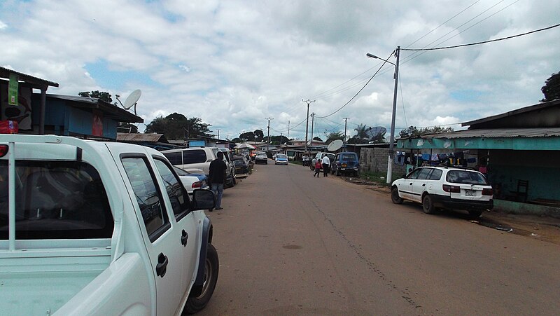
- Street in Lambaréné
- Settlement.image_shield
- Coat of arms of Lambaréné, Gabon.svg
- Settlement.pushpin_map
- Gabon
- Settlement.pushpin_label_position
- bottom
- Settlement.pushpin_map_caption
- Location in Gabon
- Settlement.subdivision_type
- Country
- Settlement.subdivision_type1
- Province
- Settlement.subdivision_name1
- Moyen-Ogooué
- Settlement.subdivision_type2
- Department
- Settlement.unit_pref
- Imperial
- Settlement.population_as_of
- 2013 census
- Settlement.population_total
- 38,775
- Settlement.population_blank1_title
- Ethnicities
- Settlement.population_blank2_title
- Religions
via Wikipedia infobox
Wikidata facts
- Country
- Gabon
- Located in
- Moyen-Ogooué Province
- Population
- 15033
- Elevation
- 26
- Capital of
- Moyen-Ogooué Province
- Image
- Mission St François Xavier à Lambaréné.jpg
Show 1 more fact
- Commons category
- Lambaréné
Sources (2)
via Wikidata · CC0
Article · Deutsch
Lambaréné (landesübliche französische Schreibweise; im Deutschen meist Lambarene) ist der Hauptort der Provinz Moyen-Ogooué in Gabun. Der Name entstammt der Sprache der Galoa, einer Ethnie Gabuns, und bedeutet „Wir wollen es versuchen“. Die 2009 etwa 26.260 Einwohner zählende Stadt liegt nur wenige Kilometer südlich des Äquators inmitten des zentralafrikanischen Regenwaldes am Fluss Ogooué. Lambaréné ist auch das wirtschaftliche Zentrum der Provinz Moyen-Ogooué. Der Hauptwirtschaftszweig ist die Fischerei. Ein neuer Hafen befindet sich im Aufbau. Heute leben in Lambaréné verschiedene Bantu-Gruppen (Fang, Bapounou, Eshira, Myéné und andere), die die ursprünglich ansässigen Pygmäen in den Osten und Norden Gabuns verdrängt haben.
Abstract from DBpedia / Wikipedia · CC BY-SA
Gallery (5)
On the map
3 mapped locations