
Mauritius
Sign in to saveAlso known as Republic of Mauritius, Maurice, Moris, MU, MRI
Mauritius, officially the Republic of Mauritius, is an island country in the Indian Ocean, located about off the southeastern coast of East Africa, east of Madagascar. It includes the main island (also called Mauritius), as well as Rodrigues, Agaléga, and St. Brandon (Cargados Carajos shoals). The islands of Mauritius and Rodrigues, along with nearby Réunion (a French overseas department), are part of the Mascarene Islands. The main island of Mauritius, where the population is concentrated, hosts the capital and largest city, Port Louis. The country spans and has an exclusive economic zone cov
OverviewAI-generated
Mauritius, officially the Republic of Mauritius, is a sovereign island and archipelagic state located in Eastern Africa. Its capital is Port Louis, and it covers an area of 2040. The country is a member of the United Nations, the Commonwealth of Nations, the African Union, and the World Trade Organization. It contains the administrative territorial entities of Rivière Noire District, Flacq District, Grand Port District, and Moka District.
The population is recorded as 1243741 or 1245779. The currency is the Mauritian rupee, and the top-level Internet domain is .mu. The national anthem is Motherland, and the flag is the flag of Mauritius. The country operates in the UTC+04:00 time zone. Head of state has included Ameenah Gurib-Fakim, Barlen Vyapoory, Prithvirajsing Roopun, and Dharam Gokhool, while the head of government is Pravind Jugnauth.
Synthesized by Vinony from 71 facts across 10 sources: Wikidata, REST Countries, Open Meteo, Openweathermap, World Bank, OpenStreetMap, Firecrawl, PubMed, Vinony graph, Geo. Generated from structured data (not the Wikipedia text) and checked against those facts — may still contain errors.
In the Vinony graph
Vinony catalogs Mauritius in its Countries collection (215 entries).
Vinony's link graph records 12,469 inbound references to Mauritius, and connects out to Mauritian Creole, African Union and Indo-Mauritian.
The entry is geolocated on the map in country, across 3 mapped points.
Vinony files it under 1638 establishments in the Dutch Empire, 1968 establishments in Africa and Countries and territories where English is an official language.
Weather now
cached 11h ago7-day forecast
via Open-Meteo
Country

- Capital
- Port Louis
- Population
- 1,243,741
- Region
- Africa · Eastern Africa
- Demonym
- Mauritian
- Currencies
- MUR (₨)
- Languages
- English, French, Mauritian Creole
- Calling code
- +230
- Drives on
- Left
- Gini
- 36.8 (2017)
- FIFA code
- MRI
- TLD
- .mu
- Timezones
- UTC+04:00
via REST Countries
Indicators · World Bank
- GDP
- $14.9B(2024)
- Population
- 1,245,779(2024)
- Life expectancy
- 73.8 yrs(2024)
- Unemployment
- 5.6 %(2025)
- Urban population
- 39 %(2024)
- Internet users
- 73.3 %(2024)
- Forest area
- 19.5 %(2023)
- Renewable energy
- 8.6 %(2021)
via World Bank Open Data · CC BY 4.0
Wikipedia views (30d)
224,062 totalvia Wikimedia Pageviews API
Key facts
- Country.map_caption2
- Islands of Mauritius labelled in black.* Tromelin Island (part of the French Southern and Antarctic Lands, claimed by Mauritius).* The Chagos Archipelago (the British Indian Ocean Territory) are set to be transferred to Mauritius in 2026.
- Country.national_motto
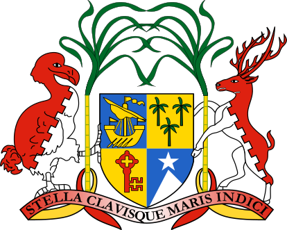
- "Star and Key of the Indian Ocean"
- Country.national_anthem
- "Motherland"File:Motherland_(instrumental).ogg
- Country.capital
- Port Louis
- Country.languages2_type
- Language spoken at home
- Country.official_languages
- None (de jure)
- Country.religion_year
- 2022
- Country.demonym
- Mauritian
- Country.largest_city
- Port Louis
- Country.government_type
- Unitary parliamentary republic
- Country.leader_title1
- President
- Country.leader_name1
- Dharam Gokhool
- Country.leader_name2
- Robert Hungley
- Country.leader_title2
- Vice-President
- Country.leader_title3
- Prime Minister
- Country.leader_name3
- Navin Ramgoolam
- Country.leader_title4
- Deputy Prime Minister
- Country.leader_name4
- Vacant
via Wikipedia infobox
Research
2,946 papers- Global Dialysis Perspective: Mauritius.Kidney360 · 2021Ip Min Wan D, Fagoonee KDOI: 10.34067/KID.0000982021
- Mauritius.Population policy compendium · 1982United Nations. Department of International Economic and Social Affairs. Population Division, United Nations Fund for Population Activities UNFPA
- An assessment of the performance of the national health research system in Mauritius.ReviewBMC health services research · 2023Musango L, Nundoochan A, Ramful Y et al.DOI: 10.1186/s12913-023-09208-x
- [Mauritius].Jeune Afrique (Paris, France : 1980) · 1996
- Mauritius.Department of State publication. Background notes series · 1988United States. Department of State. Bureau of Public Affairs
- Witchcraft, Envy, and Norm Enforcement in Mauritius.Human nature (Hawthorne, N.Y.) · 2024Willard AK, Rosun N, Lesage K et al.DOI: 10.1007/s12110-024-09484-4
- Medicinal plants brought by Indian indentured immigrants: A comparative review of ethnopharmacological uses between Mauritius and India.ReviewJournal of ethnopharmacology · 2019Mahomoodally MF, Protab K, Aumeeruddy MZDOI: 10.1016/j.jep.2019.01.012
- Spotlight: Mauritius.Population today · 1997Lutz W
via PubMed
Official website
Republic of Mauritius
govmu.org →Link to the official site · 40,000 chars · not written by Vinony
Wikidata facts
- Instance of
- country
- Named after
- Mauritius Island
- Official name
- République de Maurice
- Demonym
- Muiríseach
- Country
- Mauritius
- Contains
- Savanne District
- Continent
- Africa
- Capital
- Port Louis
- Official language
- English language
- Currency
- Mauritian rupee
- Population
- 1264613
- Area
- 2040
- Body of water
- Indian Ocean
- Head of government
- Pravind Jugnauth
- Head of state
- Dharam Gokhool
- Form of government
- parliamentary republic
- Legislature
- National Assembly of Mauritius
- Anthem
- Motherland
- Shares border with
- Maldives
- Highest point
- Piton de la Petite Rivière Noire
- Official website
- www.govmu.org
- Image
- Mauritius 23.08.2009 11-42-31.jpg
- Life expectancy
- 74.39488
- Nominal GDP
- 12898307089
Show 69 more facts
- Unemployment rate
- 8
- Calling code
- +230
- Licence plate code
- MS
- Electrical plug type
- BS 1363
- Mains voltage
- 230
- Motto
- Seren ac Allwedd Cefnfor India
- Coat of arms
- Coat of arms of Mauritius
- top-level Internet domain
- .mu
- Commons category
- Mauritius
- member of
- African Continental Free Trade Area
- topic's main category
- Category:Mauritius
- category for people born here
- Category:Births in Mauritius
- category for people who died here
- Category:Deaths in Mauritius
- topic's main Wikimedia portal
- Portal:Mauritius
- category for films shot at this location
- Category:Films shot in Mauritius
- category of associated people
- Category:Mauritian people
- diplomatic relation
- Poland
- IPA transcription
- mæʉˈɾɪtsɪʉs
- Commons gallery
- Maurice / Mauritius
- lowest point
- Indian Ocean
- mobile country code
- 617
- driving side
- left
- geography of topic
- Geography of Mauritius
- emergency phone number
- 112
- marriageable age
- 18
- native label
- République de Maurice
- office held by head of government
- Prime Minister of Mauritius
- language used
- Mauritian Sign Language
- office held by head of state
- President of Mauritius
- central bank
- Bank of Mauritius
- history of topic
- history of Mauritius
- number of out-of-school children
- 19949
- has characteristic
- free country
- located in/on physical feature
- East Africa
- total fertility rate
- 1.43
- maritime identification digits
- 645
- inception
- 1968-03-12
- different from
- Mauritius Island
- Unicode character
- 🇲🇺
- GS1 country code
- 609
- culture
- culture of Mauritius
- VAT rate
- 15
- BTI Status Index
- 8.26
- BTI Governance Index
- 6.76
- replaces
- Commonwealth realm of Mauritius
- P6413
- Mauritius
- economy of topic
- economy of Mauritius
- demographics of topic
- demographics of Mauritius
- Democracy Index
- 8.14
- described by source
- Encyclopædia Britannica 11th edition
- Human Development Index
- 0.802
- P11012
- Schwetzingen
- on focus list of Wikimedia project
- Wikipedia:Vital articles/Level/4
- Happy Planet Index score
- 51.5
- Gini coefficient
- 36.8
- Inequality-adjusted Human Development Index
- 0.666
- P12749
- Cocullo
- hashtag
- Maurice
- official symbol
- Mauritius Kestrel
- birth rate
- 9.6
- male population
- 622533
- death rate
- 10.2
- rural population
- 747287
- female population
- 639989
- urban population
- 515236
- Commonwealth Sport country code
- MRI
Sources (15)
via Wikidata · CC0
Travel guide
Understand
thumb|Chamarel Falls The country consists of the main island of Mauritius and the smaller islands of Rodrigues, the Agalegas and the Cargados Carajos shoals. The British Indian Ocean Territory is claimed by Mauritius and recognised as part of Mauritius by the United Nations, but remains under de facto British control, so we do not cover it here.
Get in
thumb|upright=1.8|A map showing the visa requirements of Mauritius
Do
thumb|right|Climbing Le Pouce
Views — For a spectacular 360⁰ view of Port Louis and the north, climb Le Pouce or ‘the thumb', at 812 m (2,664 ft). It is an easy 2-hour climb from the village of Petit Verger (near St. Pierre), and takes another 2 hour to walk into Port Louis (map). The top of Signal Mountain also offers a spectacular view of Port Louis and the North. It is much easier to climb Signal Mountain from Labourdonnais Street as there is a tarred jogging track and it takes around 45 minutes to walk to the top. Starting from Saint Louis is also possible. Tour the Moka mountains — by quad bike, horse or 4-wheel drive at the accessible 1,500-hectare (3,700-acre) nature park of Domaine Les Pailles. Travel to the sugar mill and rum distillery by train or horse-drawn carriage before dining in one of four restaurants. Deep sea fishing — Mauritius is ideally positioned for game-fishing. Depending on the time of year it is possible to catch blue or black marlin, sailfish, wahoo, yellow fin tuna, giant trevally, dogtooth tuna, bonito, dolphinfish, sharks and many more. The majority of the big game fishing boats are well equipped with VHF radio, mobile telephone, GPS navigation system, radar, radio telephone, safety equipment, Penn International reels, life jackets, medical kits, fire extinguishers, flares, and all related fishing equipment such as fighting chairs and rods (usually 9). You can choose between half day and full day fishing trips . Big game …
Eat
Don't hesitate to go to the various restaurants around the island. Although many of them advertise a specific ethnic cuisine, like everywhere around the world they have their own mix of traditional and local. You might discover that 'fried rice' can have more than one flavor. thumb|Bengali rasagulas are very popular in Mauritius. Gastronomes will find a variety of flavors and aromas inherited from the different migrations through its history. Culinary traditions from France, India, China and Eastern Africa have been passed on through generations.
Depending on the region, rice or a variety of flat bread called chapattis or roti, called farata (paratha) by the local people, is eaten with curries. The extensive use of spices like saffron, cinnamon, cardamom, and cloves and herbs such as thyme, basil, and curry leaves are the common ingredients that provide some powerful, yet subtle, flavor. Dal, a variety of lentil soup, are many and varied according to the type of lentil used; vegetables, beans, and pickles accompany the dishes. Dholl puri, originally an Indian delicacy, has become the fish and chips for Mauritians.
Biryani from Mughal origins is a dish prepared by the Muslim community, where meat is mixed with spiced rice and potatoes.
You can buy many snacks on the street including the famous gateaux piments (a variant of the Indian vadai; literally, chilly cakes), and vegetable or meat samosas (puffs), along with octopus curry in bread. The tomato and onion based dish cal…
Drink
thumb|160x160px|A bottle of Phoenix beer Mauritius produces a wide range of cane rum. It is very cheap and is a nice drink when mixed with cola and ice. A popular drink is coconut water with a dash of lime and a splash of local rum over ice.
The local beer, Phoenix, costs around Rs30 for a pint. Usually served very cold. The local Black Eagle beer, brewed in Nouvelle France is also good. A local beer called Flying Dodo also offers beer with tropical fruits mix.
The Medine Estate Refinery shop at Bambous (4 km from Flic en Flac), on the west of the Island, has a wide variety of locally produced rums and liquors.
Sleep
There are many international brand hotels andsome luxurious hotels which are owned by Mauritian companies. Self-catered bungalows and apartments are also an option, many of them located directly on the beach.
Foreigners can buy villas, many of them in compounds located on the beach, through the IRS or RES Scheme.
Stay safe
thumb|Le Morne The crime rate has fallen, and Mauritius is a much safer country for visitors than most other destinations. The Tourism Police and Coast Guards patrol regularly in areas frequented by tourists, and most cities, beaches and other major attractions are under camera surveillance. Nevertheless, you should look out for suspicious behavior.
Stay healthy
Mauritius is a risk area for infection with dengue fever, also known as "breakbone fever" from the muscular convulsions it causes. No vaccine is available. Dengue re-emerged in 2019 after several dengue-free years, so be sure to take precautious against mosquito bites.
Since 2005 during the high season a certain type of mosquito called the Aedes albopictus causes the viral illness Chikungunya and the insect is more likely to be around in the daytime.
It is important to use anti-mosquito protection at all times. Mosquitoes are more prevalent in rural areas but they can also inhabit the beach in the tourist zone and may lead to swollen joints and/or rashes. Symptoms last from one week up to several months depending how seriously you are affected. Some people recover quickly but it can take several months to recover completely.
In 1991 86% of the population had antibodies indicating that they had been exposed to the hepatitis A virus, following an epidemic of the disease in 1989. Hepatitis A vaccination is generally recommended for travel in East Africa (and most other places) by the U.S. Centers for Disease Control.
Depending on the time of the year, many of the beaches are infested with sea urchins, and it is not uncommon to see broken glass on the beach or in the water. It is a very good idea to either buy or bring plastic/wet shoes when venturing into the water. This is generally not a problem at the big hotels as the designated swimming areas on the beaches are regularl…
Connect
Mauritius has a few telecommunications companies, the main ones being Emtel and My.t. They both sell sim card and E-sim at the airport from 700 MUR per month. Passport is required.
Travel guide from Wikivoyage (CC BY-SA 4.0)
~40 min read
Encyclopedic overview
53 sectionsContents
- Etymology
- History
- Early history
- French Mauritius (1715–1810)
- British Mauritius (1810–1968)
- Independence and constitutional monarchy (1968–1992)
- Republic (since 1992)
- Geography
- Mauritius Island
- Rodrigues Island
- Chagos Archipelago
- St. Brandon
- Agaléga Islands
- Tromelin
- Chagos Archipelago territorial dispute
- Environment and climate
- Biodiversity
- Government and politics
- Administrative subdivisions
- Military
- Foreign relations
- Legal system
- Demographics
- Religion
- Languages
- Education
- Economy
- Financial services
- Tourism
- Transport
- Information and communications technology (ICT)
- Biomedical exports
- Culture
- Art
- Architecture
- Literature
- Media
- Music
- Cuisine
- Holidays and festivals
- Sports
- See also
- Notes
- References
- Bibliography
- Further reading
- Novels
- External links
- Government
- Geography
- =
- ===({{NoMoreLinks}})====
- ({{NoMoreLinks}})===============
Mauritius, officially the Republic of Mauritius, is an island country in the Indian Ocean, located about 1,100 nautical miles (2,000 km; 1,300 mi) off the southeastern coast of East Africa, east of Madagascar. It includes the main island (also called Mauritius), as well as Rodrigues, Agaléga, and St. Brandon (Cargados Carajos shoals). The islands of Mauritius and Rodrigues, along with nearby Réunion (a French overseas department), are part of the Mascarene Islands. The main island of Mauritius, where the population is concentrated, hosts the capital and largest city, Port Louis. The country spans 2,040 square kilometres (790 sq mi) and has an exclusive economic zone covering approximately 580,000 square nautical miles (2,000,000 km; 770,000 sq mi).
The 1502 Portuguese Cantino planisphere has led some historians to speculate that Arab sailors were the first to discover the uninhabited island around 975, naming it Dina Arobi. Called Ilha do Cirne or Ilha do Cerne on early Portuguese maps, the island was visited by Portuguese sailors in 1507. A Dutch fleet, under the command of Admiral Van Warwyck, landed at what is now the Grand Port District and took possession of the island in 1598, renaming it after Maurice, Prince of Orange. Short-lived Dutch attempts at permanent settlement took place over a century aimed at exploiting the local ebony forests, establishing sugar and arrack production using cane plant cuttings from Java together with over three hundred Malagasy slaves, all in vain. When French colonisation began in 1715, the island was renamed "Isle de France". In 1810, the United Kingdom seized the island and under the Treaty of Paris, France ceded Mauritius and its dependencies to the United Kingdom. The British colony of Mauritius now included Rodrigues, Agaléga, St. Brandon, the Chagos Archipelago, and, until 1906, the Seychelles. Mauritius and France dispute sovereignty over the island of Tromelin, the treaty failing to mention it specifically. Mauritius became the British Empire's main sugar-producing colony and remained a primarily sugar-dominated plantation-based colony until independence, in 1968. The country became a republic in 1992 but retained the Privy Council of the United Kingdom as highest court of appeal.
Excerpted from Wikipedia’s “Mauritius” article, available under the CC BY-SA 4.0 licence.
Gallery (59)
On the map
3 mapped locations
Available in 238 languages
- Español
- Français
- Deutsch
- 中文
- 日本語
- Русский
- Português
- Italiano
- العربية
- हिन्दी
- Abkhazian
- Afrikaans
- Albanian
- Albanian
- Amharic
- ami
- Angika
- Aragonese
Show 219 more
- Armenian
- Arpitan
- Assamese
- Asturian
- azb
- Azerbaijani
- Bahasa Indonesia
- Balinese
- Bangla
- Banjar
- Bashkir
- Basque
- bat_smg
- Bavarian
- be_x_old
- Belarusian
- Betawi
- Bhojpuri
- Bikol
- Bishnupriya
- Bislama
- Bosnian
- Breton
- Bulgarian
- Buriat
- Burmese
- Catalan
- cbk_zam
- cdo
- Cebuano
- Central Kurdish
- Chechen
- Chuvash
- Cornish
- Corsican
- Crimean Tatar
- Croatian
- Czech
- dag
- Danish
- Divehi
- dty
- Dzongkha
- Egyptian Arabic
- Esperanto
- Estonian
- Ewe
- Extremaduran
- Faroese
- Fiji Hindi
- Filipino
- Finnish
- fiu_vro
- Fula
- Gagauz
- Galician
- Ganda
- gcr
- Georgian
- Gilaki
- Goan Konkani
- gpe
- Greek
- Guarani
- Gujarati
- Haitian Creole
- Hakka Chinese
- Hausa
- Hawaiian
- Hebrew
- Hungarian
- Icelandic
- Ido
- Igbo
- Iloko
- Inari Sami
- Interlingua
- Interlingue
- Irish
- Jamaican Creole English
- Javanese
- Kannada
- Kara-Kalpak
- Karachay-Balkar
- Kashmiri
- Kazakh
- Kikuyu
- Kinyarwanda
- Kongo
- Kotava
- Kurdish
- Kyrgyz
- Ladino
- Latin
- Latvian
- Ligurian
- Limburgish
- Lingala
- Lingua Franca Nova
- Lithuanian
- lld
- Lombard
- Low German
- Lower Sorbian
- Luxembourgish
- Macedonian
- Malagasy
- Malay
- Malayalam
- Maltese
- Manipuri
- Manx
- Māori
- Marathi
- Mari
- Mazanderani
- Minangkabau
- Mingrelian
- Mongolian
- Moroccan Arabic
- nds_nl
- Nederlands
- Nepali
- Nigerian Pidgin
- Northern Frisian
- Northern Sami
- Northern Sotho
- Norwegian
- Norwegian Nynorsk
- Novial
- Obolo
- Occitan
- Odia
- Old English
- olo
- Oromo
- Ossetic
- Pampanga
- Papiamento
- Pashto
- Piedmontese
- Polski
- Punjabi
- Quechua
- Romanian
- Rusyn
- Samoan
- Sango
- Sanskrit
- Santali
- Sardinian
- Saterland Frisian
- Scots
- Scottish Gaelic
- Serbian
- Serbian (Latin)
- Shan
- Shona
- Sicilian
- Silesian
- simple
- Sindhi
- Sinhala
- Slovak
- Slovenian
- Somali
- Southern Sotho
- Standard Moroccan Tamazight
- Sundanese
- Svenska
- Swahili
- Swati
- szy
- Tahitian
- Tajik
- Talysh
- Tamil
- Taroko
- Tatar
- tay
- Telugu
- Tibetan
- Tiếng Việt
- Toki Pona
- Tsonga
- Tswana
- Tumbuka
- Türkçe
- Turkmen
- Udmurt
- Ukrainian
- Upper Sorbian
- Urdu
- Uyghur
- Uzbek
- Venetian
- Veps
- Volapük
- Walloon
- Waray
- Welsh
- Western Frisian
- Western Mari
- Western Panjabi
- Wolof
- Wu Chinese
- Yakut
- Yiddish
- Yoruba
- Zaza
- Zeelandic
- zh_classical
- zh_min_nan
- zh_yue
- Zhuang
- Zulu
- فارسی
- ไทย
- 한국어
via Wikidata sitelinks · CC0