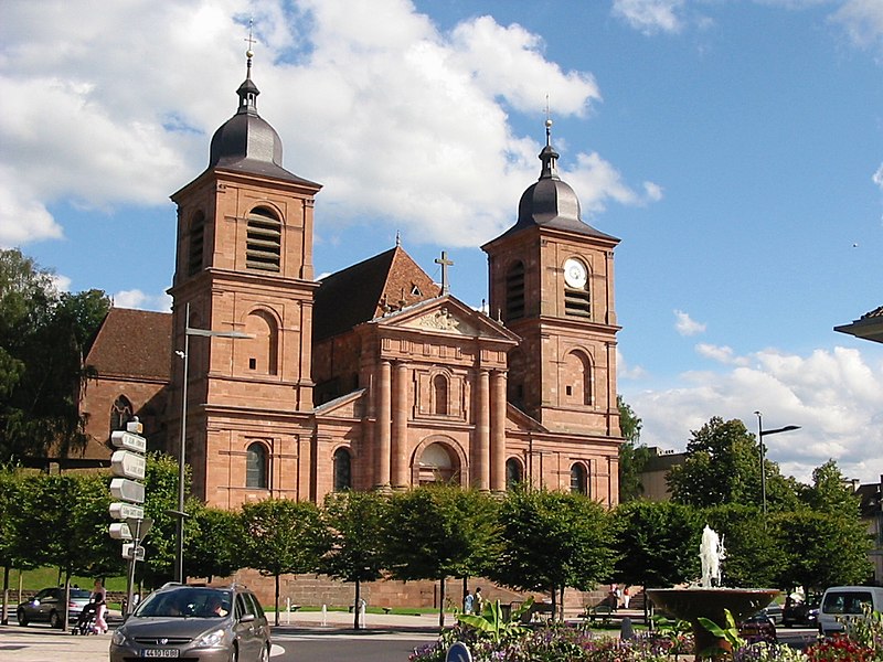
孚日圣迪耶
Also known as Saint-Dié, St-Dié, St-Dié-des-Vosges
法国孚日省市镇与副省会
AI overview
Saint-Dié-des-Vosges is a town located in the Vosges department in northeastern France. The town was officially renamed in 1999 to include "des-Vosges," clarifying its geographical location in the Vosges region.
AI-generated from the Wikipedia summary — may contain errors.
Weather now
cached 20h ago20°clear sky
61% 2.5 m/s OpenWeatherMap
7-day forecast
via Open-Meteo
Place details
- Locality
- Saint-Dié-des-Vosges
- Region
- Grand Est
- Country
- France
- Population
- 24,628
Travel guide
Understand
thumb|La Meurthe at Saint-Dié-des-Vosges A major part was destroyed in November, 1944 and was rebuilt largely in a material imitating red sandstone.
After World War II, the right bank of the river Meurthe was completely razed and most people lived outside the town in wood cabins for decades. The radical plan created by Le Corbusier in 1945, which called for a large plaza with factories and other buildings in the heart of the city, was rejected in 1947, and only one private factory belonging to Jean-Jacques Duval was ever built. There were no means nor materials in this terrible period and the great street called "rue Thiers" was finished only at the end of 1954.
The river Meurthe flows in the Permian basin of Saint-Dié surrounded by wooded mountains Ormont, Kemberg and La Madeleine. The peaks of these mountains are 550 metres (1,800 feet) high, and are composed of Triassic formations, especially the so-called "Vosges sandstone", a kind of red sandstone.
Get in
Saint-Dié is 80 km (50 mi) southeast of Nancy and 45 km (28 mi) of Lunéville.
Get around
The urban transit bus network is called "Sylvia".
Do
The city has 220 km of marked hiking trails including the #533 long-distance hiking trail linking Moselle Lorraine to the Vosges counties. Le Chemin des Abbayes. Short railway cycle path that connects 3 abbeys, 8 km from Étival to Senones.
Travel guide from Wikivoyage (CC BY-SA 4.0)
Article · 中文
孚日圣迪耶(法語:Saint-Dié-des-Vosges,法语发音:[sɛ̃ dje de voʒ] ()),法国东北部城市,大东部大区孚日省的一个市镇,同时也是该省的一个副省会,下辖孚日圣迪耶区,其市镇面积为46.15平方公里,2019年1月1日时人口数量为19,576人,是该省人口第二多的市镇,在法国城市中排名第488位。 孚日圣迪耶位于孚日省东部,默尔特河畔,市区位于一处山间谷地,其附近区域被称为“”,自中世纪起便成为该区域的行政中心,现代则为一个区域性的工商业城市和交通枢纽,有高速列车可直达巴黎。 孚日圣迪耶被称为“世界地理之都”(Capital mondiale de la géographie)。16世纪初,德国地理学家马丁·瓦尔德泽米勒在此发表了《宇宙学入门》以及《瓦尔德泽米勒地图》,首次将北美大陆命名为“亚美利加”。该市自1990年起每年秋季举办,其间颁布的被认为是世界地理学领域的最高荣誉。
Abstract from DBpedia / Wikipedia · CC BY-SA
Gallery (11)
On the map
3 mapped locations