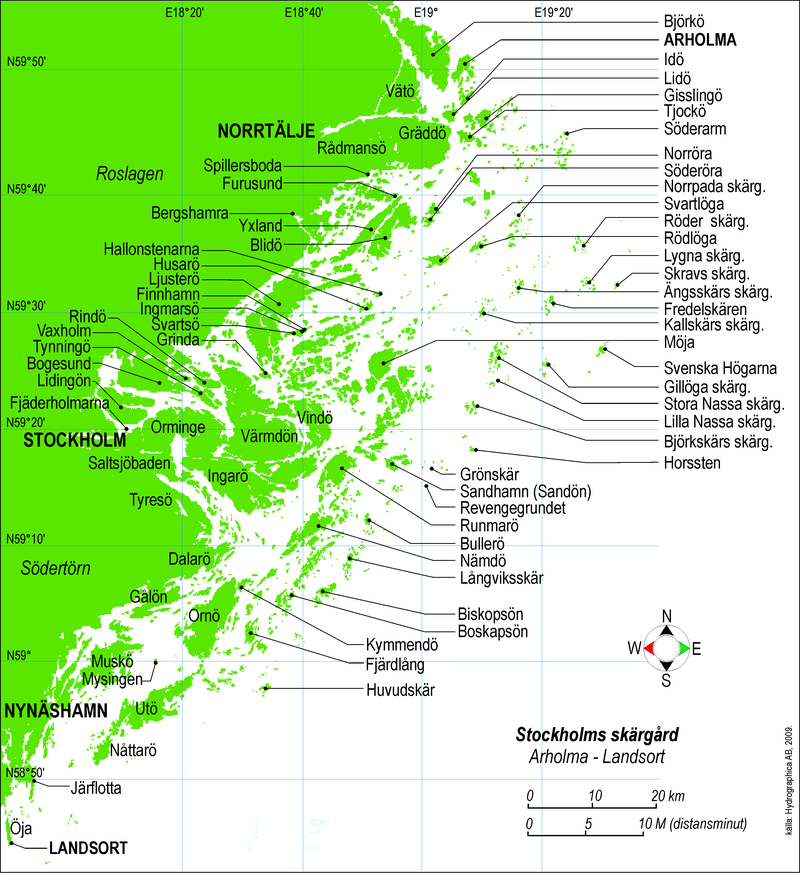
File:Stockholms_skärgård.png · Wikimedia Commons · See Wikimedia Commons
Stockholm archipelago
Sign in to saveAlso known as Stockholms skärgård
archipelago north of Stockholm, Sweden
In the Vinony graph
Within Vinony's link graph, Stockholm archipelago is referenced by 353 other articles, and connects out to Larsmo, Värmdö and Waxholmsbolaget.
The entry is geolocated on the map.
It is catalogued under topics including Geography articles needing translation from Swedish Wikipedia, Geography of Stockholm and Landforms of Stockholm County.
Its subject is documented across 38 Wikipedia language editions.
Key facts
- Location
- Baltic Sea
- Total islands
- 34,316
- Major islands
- Dalarö , Finnhamn , Nässlingen [ sv ] , Grinda , Husarö , Ingarö , Ljusterö , Möja , Nämdö [ sv ] , Rödlöga , Tynningö , Utö , Svartsö , Värmdö
- County
- Stockholm County
- Official name
- Svenska Högarna-Nassa
- Designated
- 12 June 1989
via Wikipedia infobox
Wikidata facts
- Instance of
- archipelago
- Country
- Sweden
- Located in
- Stockholm County
- Area
- 530
- Image
- Söderarms skärgård.jpg
- Connects with
- Stockholm Archipelago Trail
Show 3 more facts
- Commons category
- Stockholm archipelago
- topic's main category
- Category:Stockholm archipelago
- Commons gallery
- Stockholms skärgård
Sources (2)
via Wikidata · CC0
~6 min read
Encyclopedic overview
(Learn how and when to remove this message)
The Stockholm Archipelago (Swedish: Stockholms skärgård) is the largest archipelago in Sweden, and the second-largest archipelago in the Baltic Sea (the largest being the Archipelago Sea across the Baltic in Finland). Part of the archipelago has been designated as a Ramsar site since 1989.
Excerpted from Wikipedia’s “Stockholm archipelago” article, available under the CC BY-SA 4.0 licence.