File:Cartesian-coordinate-system.svg · Wikimedia Commons · See Wikimedia Commons
Cartesian coordinate system
Sign in to saveAlso known as Cartesian coordinates
coordinate system that specifies each point uniquely by a pair of real numbers called coordinates
A Cartesian coordinate system is a way to pinpoint any location on a flat surface by using just two numbers, called coordinates. This system matters because it provides a simple, universal method for describing positions precisely, which is essential for everything from mapping and navigation to mathematics and computer graphics.
AI-generated from the Wikipedia summary — may contain errors.
Wikidata facts
- Image
- Kartesisches system.svg
Show 2 more facts
- Commons category
- Cartesian coordinates
- Stack Exchange tag
- stackoverflow.com/tags/cartesian-coordinates
via Wikidata · CC0
~34 min read
Article
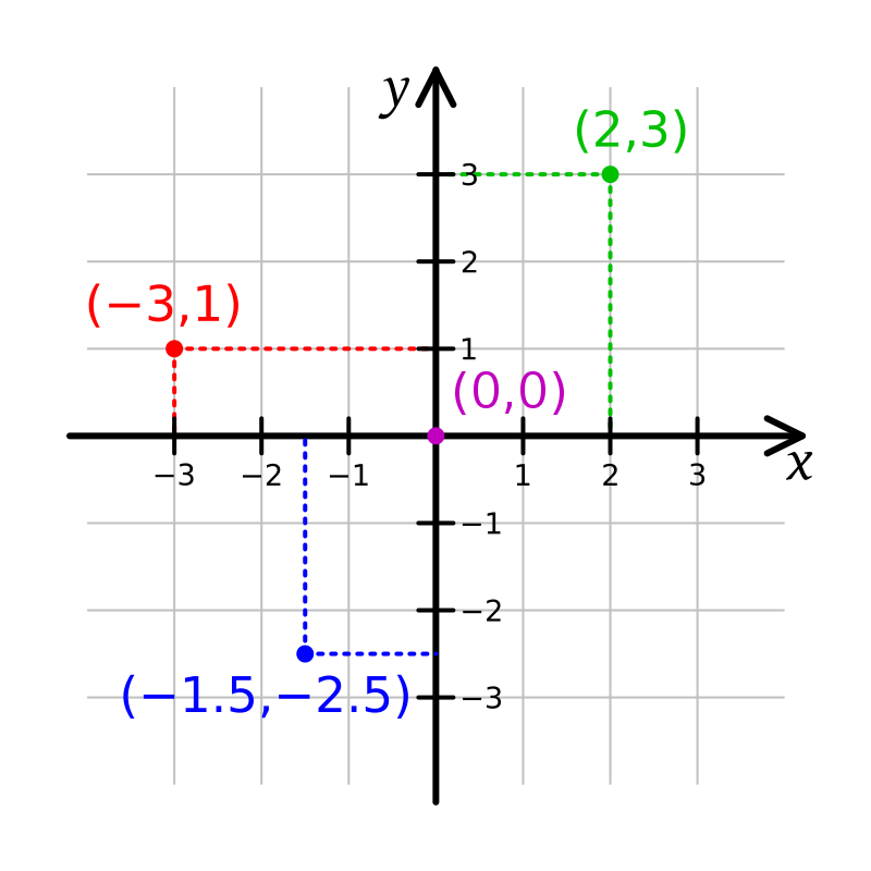
Illustration of a Cartesian coordinate plane. Four points are marked and labeled with their coordinates: (2, 3) in green, (−3, 1) in red, (−1.5, −2.5) in blue, and the origin (0, 0) in purple.
In geometry, a Cartesian coordinate system ( UK: /kɑːrˈtiːzjən/, US: /kɑːrˈtiːʒən/) in a plane is a coordinate system that specifies each point uniquely by a pair of real numbers called coordinates, which are the signed distances to the point from two fixed perpendicular oriented lines, called coordinate lines, coordinate axes or just axes (plural of axis) of the system. The point where the axes meet is called the origin and has (0, 0) as coordinates. The axes directions represent an orthogonal basis. The combination of origin and basis forms a coordinate frame called the Cartesian frame.
Gallery (11)
Available in 75 languages
- Español
- Français
- Deutsch
- 中文
- 日本語
- Русский
- Português
- Italiano
- العربية
- हिन्दी
- Afrikaans
- Albanian
- Armenian
- Asturian
- Azerbaijani
- Bahasa Indonesia
- Bangla
- Bashkir
Show 56 more
- Basque
- Bosnian
- Bulgarian
- Burmese
- Catalan
- Central Kurdish
- Chuvash
- Croatian
- Czech
- Danish
- Esperanto
- Estonian
- Finnish
- Galician
- Georgian
- Greek
- Hebrew
- Hungarian
- Icelandic
- Ido
- Irish
- Kazakh
- Kikuyu
- Latin
- Latvian
- Lithuanian
- Low German
- Macedonian
- Malay
- Malayalam
- Marathi
- Nederlands
- Norwegian
- Norwegian Nynorsk
- Polski
- Punjabi
- Romanian
- Serbian
- Serbian (Latin)
- Sicilian
- simple
- Slovak
- Slovenian
- Svenska
- Tamil
- Tiếng Việt
- Türkçe
- Ukrainian
- Urdu
- Uzbek
- Welsh
- Wu Chinese
- zh_yue
- فارسی
- ไทย
- 한국어
via Wikidata sitelinks · CC0