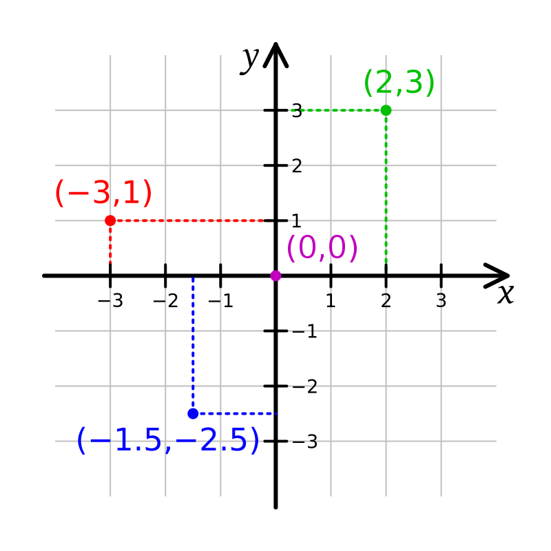
File:Cartesian-coordinate-system.svg · Wikimedia Commons · See Wikimedia Commons
ระบบพิกัดคาร์ทีเซียน
Sign in to saveAlso known as Cartesian coordinates
coordinate system that specifies each point uniquely by a pair of real numbers called coordinates
AI overview
A Cartesian coordinate system is a way to pinpoint any location on a flat surface by using just two numbers, called coordinates. This system matters because it provides a simple, universal method for describing positions precisely, which is essential for everything from mapping and navigation to mathematics and computer graphics.
AI-generated from the Wikipedia summary — may contain errors.
Wikidata facts
- Named after
- René Descartes
- Image
- Kartesisches system.svg
Show 5 more facts
- Commons category
- Cartesian coordinates
- Stack Exchange tag
- stackoverflow.com/tags/cartesian-coordinates
- facet of
- analytic geometry
- on focus list of Wikimedia project
- Wikipedia:Vital articles/Level/4
- maintained by WikiProject
- WikiProject Mathematics
via Wikidata · CC0
Gallery (11)
Available in 75 languages
- Español
- Français
- Deutsch
- 中文
- 日本語
- Русский
- Português
- Italiano
- العربية
- हिन्दी
- Afrikaans
- Albanian
- Armenian
- Asturian
- Azerbaijani
- Bahasa Indonesia
- Bangla
- Bashkir
Show 56 more
- Basque
- Bosnian
- Bulgarian
- Burmese
- Catalan
- Central Kurdish
- Chuvash
- Croatian
- Czech
- Danish
- Esperanto
- Estonian
- Finnish
- Galician
- Georgian
- Greek
- Hebrew
- Hungarian
- Icelandic
- Ido
- Irish
- Kazakh
- Kikuyu
- Latin
- Latvian
- Lithuanian
- Low German
- Macedonian
- Malay
- Malayalam
- Marathi
- Nederlands
- Norwegian
- Norwegian Nynorsk
- Polski
- Punjabi
- Romanian
- Serbian
- Serbian (Latin)
- Sicilian
- simple
- Slovak
- Slovenian
- Svenska
- Tamil
- Tiếng Việt
- Türkçe
- Ukrainian
- Urdu
- Uzbek
- Welsh
- Wu Chinese
- zh_yue
- فارسی
- ไทย
- 한국어
via Wikidata sitelinks · CC0