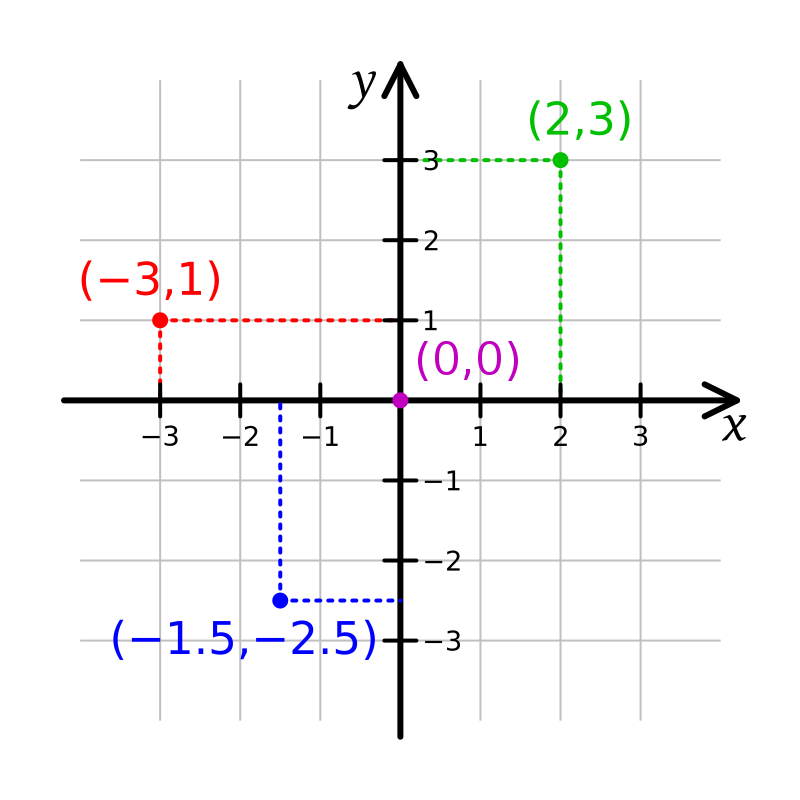
File:Cartesian-coordinate-system.svg · Wikimedia Commons · See Wikimedia Commons
A Cartesian coordinate system is a way to pinpoint any location on a flat surface by using just two numbers, called coordinates. This system matters because it provides a simple, universal method for describing positions precisely, which is essential for everything from mapping and navigation to mathematics and computer graphics.
AI-generated from the Wikipedia summary — may contain errors.
In the Vinony graph
Vinony's link graph records 1,450 inbound references to نظام إحداثي ديكارتي, and connects out to line, vertical and horizontal and coordinate system.
Vinony files it under Analytic geometry, Elementary mathematics and Orthogonal coordinate systems.
Vinony links it to 75 Wikipedia language editions.
Wikidata facts
- Named after
- René Descartes
- Image
- Kartesisches system.svg
Show 5 more facts
- Commons category
- Cartesian coordinates
- Stack Exchange tag
- stackoverflow.com/tags/cartesian-coordinates
- facet of
- analytic geometry
- on focus list of Wikimedia project
- Wikipedia:Vital articles/Level/4
- maintained by WikiProject
- WikiProject Mathematics
via Wikidata · CC0
Gallery (11)
Available in 75 languages
- Español
- Français
- Deutsch
- 中文
- 日本語
- Русский
- Português
- Italiano
- العربية
- हिन्दी
- Afrikaans
- Albanian
- Armenian
- Asturian
- Azerbaijani
- Bahasa Indonesia
- Bangla
- Bashkir
Show 56 more
- Basque
- Bosnian
- Bulgarian
- Burmese
- Catalan
- Central Kurdish
- Chuvash
- Croatian
- Czech
- Danish
- Esperanto
- Estonian
- Finnish
- Galician
- Georgian
- Greek
- Hebrew
- Hungarian
- Icelandic
- Ido
- Irish
- Kazakh
- Kikuyu
- Latin
- Latvian
- Lithuanian
- Low German
- Macedonian
- Malay
- Malayalam
- Marathi
- Nederlands
- Norwegian
- Norwegian Nynorsk
- Polski
- Punjabi
- Romanian
- Serbian
- Serbian (Latin)
- Sicilian
- simple
- Slovak
- Slovenian
- Svenska
- Tamil
- Tiếng Việt
- Türkçe
- Ukrainian
- Urdu
- Uzbek
- Welsh
- Wu Chinese
- zh_yue
- فارسی
- ไทย
- 한국어
via Wikidata sitelinks · CC0