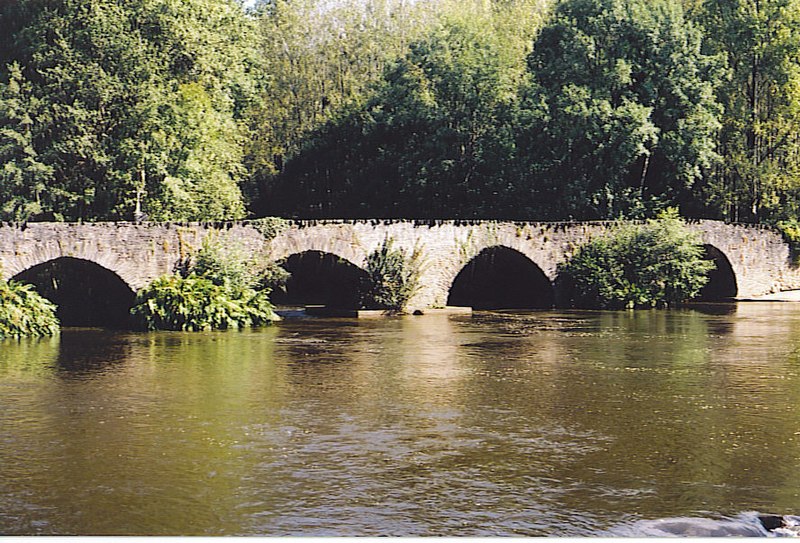
File:Vézère_vieux_pont.jpg · Wikimedia Commons · See Wikimedia Commons
In the Vinony graph
Within Vinony's link graph, 韦泽尔谷 is referenced by 93 other articles, and connects out to World Heritage Site, Prehistoric Sites and Decorated Caves of the Vézère Valley and Font-de-Gaume.
The entry is geolocated on the map, across 3 mapped points.
It is catalogued under topics including Geography articles needing translation from French Wikipedia, Nouvelle-Aquitaine region articles needing translation from French Wikipedia and Rivers of Corrèze.
Its subject is documented across 41 Wikipedia language editions.
Key facts
- River.name
- Vézère
- River.image
- Vézère vieux pont.jpg
- River.image_caption
- Le Saillant, bridge over the river Vézère
- River.map
- Vézère.png
- River.source1_location
- Plateau de Millevaches
- River.mouth_location
- Dordogne
- River.subdivision_type1
- Country
- River.subdivision_name1
- France
- UNESCO World Heritage Site.WHS
- Prehistoric Sites and Decorated Caves of the Vézère Valley
- UNESCO World Heritage Site.image
- Vezere madelaine.JPG
- UNESCO World Heritage Site.image_upright
- 1.2
- UNESCO World Heritage Site.caption
- Vézère at La Madeleine site
- UNESCO World Heritage Site.criteria
- (i)(iii)
- UNESCO World Heritage Site.ID
- 85
- UNESCO World Heritage Site.year
- 1979
via Wikipedia infobox
Article · 中文
韋澤爾河(法語:Vézère,法语发音:[vezɛʁ];奧克語:Vesera)是法國的河流,屬於多爾多涅河的支流,河道全長211公里,流域面積3,708平方公里,平均流量每秒50立方米,發源自梅马克,河口處在利默伊。
Abstract from DBpedia / Wikipedia · CC BY-SA
Gallery (6)
On the map
3 mapped locations