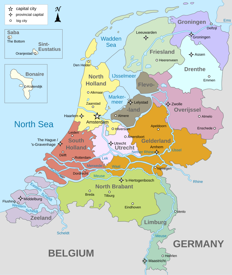
File:Map_provinces_Netherlands-en.svg · Wikimedia Commons · See Wikimedia Commons
province of the Netherlands
Also known as provinces of the Netherlands, Dutch province, Dutch provinces
first-level administrative division in the Netherlands
AI overview
A province of the Netherlands is a regional government area that serves as the country's main administrative division. These provinces matter because they handle important local responsibilities like public health, education, and infrastructure within their territories.
AI-generated from the Wikipedia summary — may contain errors.
Wikidata facts
Show 2 more facts
- Commons category
- Provinces of the Netherlands
- quantity
- 12
Sources (1)
via Wikidata · CC0
~9 min read
Article
There are twelve provinces (Dutch: provincies [proːˈvɪnsis] or provinciën [proːˈvɪnsijə(n)] ; sing. provincie [ˌproːˈvɪnsi] ) of the Netherlands representing the administrative layer between the national government and the local governments, with responsibility for matters of subnational or regional importance.
The most populous province is South Holland, with just over 3.8 million inhabitants as of January 2023, and also the most densely populated province with 1,410/km (3,700/sq mi). With 391,124 inhabitants, Zeeland has the smallest population. However, Drenthe is the least densely populated province with 191/km (490/sq mi). In terms of area, Friesland is the largest province with a total area of 5,753 km (2,221 sq mi). If water is excluded, Gelderland is the largest province by land area at 4,960 km (1,915 sq mi). The province of Utrecht is the smallest with a total area of 1,560 km (602 sq mi), while Flevoland is the smallest by land area at 1,410 km (544 sq mi). In total about 10,000 people were employed by the provincial administrations in 2018.